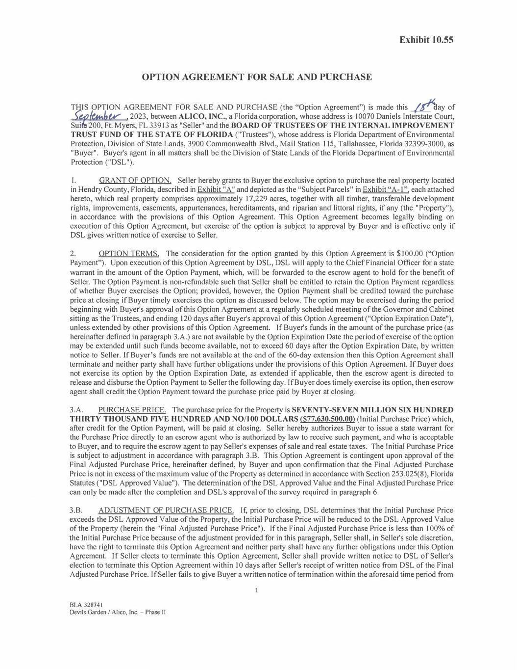
OPTION AGREEMENT FOR SALE AND PURCHASE THIS OPTION AGREEMENT FOR SALE AND PURCHASE (the "Option Agreement") is made this _/£day of -�t�l,v , 2023, between ALI CO, INC., a Florida corporation, whose address is I 0070 Daniels Interstate Court, Sui e 200, Ft. Myers, FL 33913 as "Seller" and the BOARD OF TRUSTEES OF THE INTERNAL IMPROVEMENT TRUST FUND OF THE ST ATE OF FLORIDA ("Trustees"), whose address is Florida Department of Environmental Protection, Division of State Lands, 3900 Commonwealth Blvd., Mail Station 115, Tallahassee, Florida 32399-3000, as "Buyer". Buyer"s agent in all matters shall be the Division of State Lands of the Florida Department of Environmental Protection ("DSL"). I. GRANT OF OPTION. Seller hereby grants to Buyer the exclusive option to purchase the real property located in Hendry County, Florida, described in Exhibit "A" and depicted as the "Subject Parcels" in Exhibit "A-1", each attached hereto, which real property comprises approximately 17,229 acres, together with all timber, transferable development rights, improvements, easements, appurtenances, hereditaments, and riparian and littoral rights, if any (the "Property"), in accordance with the provisions of this Option Agreement. This Option Agreement becomes legally binding on execution of this Option Agreement, but exercise of the option is subject to approval by Buyer and is effective only if DSL gives written notice of exercise to Seller. 2. OPTION TERMS. The consideration for the option granted by this Option Agreement is $100.00 ("Option Payment"). Upon execution of this Option Agreement by DSL, DSL will apply to the ChiefFinancial Officer for a state warrant in the amount of the Option Payment, which, will be forwarded to the escrow agent to hold for the benefit of Seller. The Option Payment is non-refundable such that Seller shall be entitled to retain the Option Payment regardless of whether Buyer exercises the Option; provided, however, the Option Payment shall be credited toward the purchase price at closing if Buyer timely exercises the option as discussed below. The option may be exercised during the period beginning with Buyer's approval of this Option Agreement at a regularly scheduled meeting of the Governor and Cabinet sitting as the Trustees, and ending 120 days after Buyer's approval of this Option Agreement ("Option Expiration Date"), unless extended by other provisions of this Option Agreement. If Buyer's funds in the amount of the purchase price (as hereinafter defined in paragraph 3.A.) are not available by the Option Expiration Date the period of exercise of the option may be extended until such funds become available, not to exceed 60 days after the Option Expiration Date, by written notice to Seller. If Buyer's funds are not available at the end of the 60-day extension then this Option Agreement shall terminate and neither party shall have further obligations under the provisions of this Option Agreement. If Buyer does not exercise its option by the Option Expiration Date, as extended if applicable, then the escrow agent is directed to release and disburse the Option Payment to Seller the following day. If Buyer does timely exercise its option, then escrow agent shall credit the Option Payment toward the purchase price paid by Buyer at closing. 3.A. PURCHASE PRICE. The purchase price for the Property is SEVENTY-SEVEN MILLION SIX HUNDRED THIRTY THOUSAND FIVE HUNDRED AND NO/JOO DOLLARS ($77,630,500.00) (Initial Purchase Price) which, after credit for the Option Payment, will be paid at closing. Seller hereby authorizes Buyer to issue a state warrant for the Purchase Price directly to an escrow agent who is authorized by law to receive such payment, and who is acceptable to Buyer, and to require the escrow agent to pay Seller's expenses of sale and real estate taxes. The Initial Purchase Price is subject to adjustment in accordance with paragraph 3.B. This Option Agreement is contingent upon approval of the Final Adjusted Purchase Price, hereinafter defined, by Buyer and upon confirmation that the Final Adjusted Purchase Price is not in excess of the maximum value of the Property as determined in accordance with Section 253.025(8), Florida Statutes ("DSL Approved Value"). The determination of the DSL Approved Value and the Final Adjusted Purchase Price can only be made after the completion and DSL's approval of the survey required in paragraph 6. 3.B. ADJUSTMENT OF PURCHASE PRICE. If, prior to closing, DSL determines that the Initial Purchase Price exceeds the DSL Approved Value of the Property, the Initial Purchase Price will be reduced to the DSL Approved Value of the Property (herein the "Final Adjusted Purchase Price"). If the Final Adjusted Purchase Price is less than 100% of the Initial Purchase Price because of the adjustment provided for in this paragraph, Seller shall, in Seller's sole discretion, have the right to terminate this Option Agreement and neither party shall have any further obligations under this Option Agreement. If Seller elects to terminate this Option Agreement, Seller shall provide written notice to DSL of Seller's election to terminate this Option Agreement within 10 days after Seller's receipt of written notice from DSL of the Final Adjusted Purchase Price. If Seller fails to give Buyer a written notice of termination within the aforesaid time period from BLA 328741 Devils Garden I Alico, Inc. - Phase 11 Exhibit 10.55
receipt of DSL's written notice, then Seller shall be deemed to have waived any right to terminate this Option Agreement based upon a reduction in the Initial Purchase Price pursuant to the provisions of this paragraph 3.B. The Final Adjusted Purchase Price as calculated in this paragraph 3.B. is subject to further adjustment in accordance with the provisions of this Option Agreement. The Initial Purchase Price and the Final Adjusted Purchase Price, whichever is applicable depending on whether or not an adjustment has occurred under the provisions of this paragraph 3.B. are hereinafter referred to as the "Purchase Price". 4. ENVIRONMENTAL SITE ASSESSMENT. Buyer, prior to the exercise of the option and at its sole cost and expense, may conduct an environmental site assessment of the Property to determine the existence and extent, if any, of any Hazardous Materials on the Property. Further investigations, testing, monitoring or environmental site assessments are required by DSL to determine the existence or extent of Hazardous Materials on the Property, Buyer, at its sole option may elect to extend the Option Expiration Date to conduct such procedures at the Buyer's sole cost and expense. For purposes of this Option Agreement "Hazardous Materials" shall mean any hazardous or toxic substance, material or waste of any kind or any other substance which is regulated by any Environmental Law (as hereinafter defined in paragraph 5). 5. HAZARDOUS MATERIALS. If the environmental site assessment provided for in paragraph 4 confirms the presence of Hazardous Materials on the Property, Buyer, at its sole option, may elect to terminate this Option Agreement and neither party shall have any further obligations under this Option Agreement. Should Buyer elect not to terminate this Option Agreement, Seller shall (subject to the terms of this Section 5), at Seller's sole cost and expense and prior to the exercise of the option and closing, promptly commence and diligently pursue any assessment, clean up and monitoring of the Property necessary to bring the Property into full compliance with Environmental Law to DSL's satisfaction in its sole discretion. "Environmental Law" shall mean all federal, state and local laws, including statutes, regulations, ordinances, codes, rules, judgments, orders, decrees, permits, concessions, grants, franchises, licenses, agreements and other governmental restrictions relating to the protection of the environment or human health, welfare or safety, or to the emission, discharge, seepage, release or threatened release of any contaminant, solid waste, hazardous waste, pollutant, irritant, petroleum product, waste product, radioactive material, flammable or corrosive substance, carcinogen, explosive, polychlorinated biphenyl, asbestos, hazardous or toxic substance, material or waste of any kind into the environment, including, without limitation, ambient air, surface water, ground water, or land including, but not limited to, the Federal Solid Waste Disposal Act, the Federal Clean Air Act, the Federal Clean Water Act, the Federal Resource and Conservation and Recovery Act of 1976, the Hazardous and Solid Waste Amendments of 1984, the Federal Comprehensive Environmental Response, Compensation and Liability Act of 1980, the Federal Superfund Amendments and Reauthorization Act of 1986, Chapters 161, 253, 373, 376 and 403, Florida Statutes, Rules of the U.S. Environmental Protection Agency, Rules of the Florida Department of Environmental Protection, and the rules of the Florida water management districts now or at any time hereafter in effect. However, should the estimated cost to Seller of clean-up of Hazardous Materials exceed a sum which is equal to 0% of the Initial Purchase Price as stated in paragraph 3.A. Seller may elect to terminate this Option Agreement and neither party shall have any further obligations under this Option Agreement. 6. SURVEY. Buyer may have the Property surveyed at its expense. If the survey ("Survey"), certified by professional surveyor and mapper licensed by the State of Florida, shows any reduction in acreage from the appraised acreage to the surveyed acreage, any encroachment on the Property or that improvements intended to be located on the Property encroach on the land of others, the same shall be treated as a title defect. Buyer shall notify Seller in writing within the time period for Buyer to notify Seller of any title defects, specifying any matters shown on the Survey which adversely affect the title to the Property and the same shall be deemed to be title defects which shall be dealt with within the same time, manner, and subject to the limitations provided in paragraph 8. 7. TITLE INSURANCE. Buyer may provide a marketable title insurance commitment, to be followed by an owner's marketable title insurance policy (ALTA Form "B" with Florida revisions) from a title insurance company approved by DSL, insuring marketable title to the Property in the amount of the Purchase Price at Buyer's expense. 8. DEFECTS IN TITLE. Within sixty (60) days after this Option is executed by both parties, Buyer shall give written notice to Seller of any matters set forth in the title commitment obtained by Buyer pursuant to paragraph 7 above that are objectionable to, or deemed a title defect, by Buyer ("Notice of Title Objections"). Buyer's delivery of the Notice of Title Objections to Seller shall include therewith copies of all exception documents referenced in Schedule B, Section 2 of the title insurance commitment. Notwithstanding anything in this Option Agreement to the contrary, Seller shall be obligated to cure the following defects to the extent that and only to the extent that the same are specified in the Title 2 KA 328741 Devils Garden / Alico, Inc. — Phase II
Commitment and in Buyer's Notice of Title Objections (collectively, the "Mandatory Cure Defects"): (1) mortgages and any other secured interests arising through Seller (subject to the secured parties' consent), (2) construction liens arising through Seller, (3) back taxes on the Property that are due and payable, (4) judgment liens arising through Seller, and (5) other liens or encumbrances arising through Seller and securing a specific dollar amount. As to any defects other than Mandatory Cure Defects, Seller shall have fifteen (15) days from receipt of the Notice of Title Objections in which to elect either to (i) notify Buyer that it intends to cure the identified objections and defects on or before the Closing Date (the "Title Cure Period") and Seller shall use reasonable efforts to cure such objections and defects; or (ii) notify Buyer that Seller elects not to cure the objections or alleged defects. In the event Seller fails to deliver a response within fifteen (15) days after receipt from Buyer of the Notice of Title Objections, Seller shall be deemed to have elected not to cure or eliminate said objections and alleged title defects. Buyer shall have until the expiration of the Option Expiration Date of Seller's election (or deemed election) not to cure Buyer's objections and alleged title defects, in which to elect either (1) to terminate the Option Agreement, (2) to require Seller to deliver title in its then existing condition (with no reduction in the purchase price) and to proceed to Closing notwithstanding the objections to title raised by Buyer, yet still subject to Seller's obligation to cure the Mandatory Cure Defects, (3) extend the amount of time Seller has to remove the title defect(s), or (aa) by mutual agreement with Seller, cut out the affected parcel of the Property and reduce the value of the Property by an amount equal to the product of the per acre value of the Property, multiplied by the acreage cut out. 9. INTEREST CONVEYED. At closing, Seller shall execute and deliver to Buyer a statutory warranty deed in accordance with the provisions of Section 689.02, Florida Statutes, conveying marketable title to the Property in fee simple free and clear of all liens, reservations, restrictions, easements, leases, tenancies and other encumbrances, except for the Permitted Exceptions. No interest in (or any allocation of water permitted by) Water Use Permits 26-00453-W, 26-00453-S (Drainage), 26-00453-S (Center Pivot), 26-00108-W, 26-00483-S, 26-00483-W, 26-00323-E, and 26-00522- S (the "Permits") are being conveyed to Buyer. Buyer acknowledges and agrees that Seller will, either before or after closing, cause the Permits to be modified with SFWMD such that, as applicable, the allocation of any and all water allocated to the Property pursuant to the Permits will be reallocated to other lands owned by Seller and that in any event after such modification the Permits will no longer apply to the Property. At closing, Seller shall disclaim any and all interest Seller may have in and to any other permits pertaining to the Property. For purposes of this Option Agreement, the term "Permitted Exceptions" shall mean: (i) applicable zoning and building ordinances and land use regulations; (ii) the lien of any and all taxes and assessments not yet due and payable; (iii) easements, licenses, covenants, conditions, restrictions, leases, reservations, exceptions and other encumbrances referenced in the Title Commitment and not specifically objected to by Buyer in the Notice of Title Objections (defined below); (iv) any exceptions caused by Buyer, its agents, representatives or employees; (v) any matters accepted or deemed accepted by Buyer pursuant to the terms and conditions of this Option Agreement, and (vi) any matters agreed to by the parties in writing. This Option Agreement is contingent on the modification of certain access easements and drainage easements agreed to in writing by the Seller and Buyer, which modification must meet Buyer's reasonable approval. 10. PREPARATION OF CLOSING DOCUMENTS. Upon execution of this Option Agreement, Seller shall submit to Buyer a properly completed and executed beneficial interest affidavit and disclosure statement as required by Sections 286.23, 375.031(1) and 380.08(2), Florida Statutes. Buyer shall prepare the deed described in paragraph 9 of this Option Agreement, Buyer's and Seller's closing statements and the title, possession and lien affidavit certified to Buyer and title insurer and an environmental affidavit on DSL forms provided by DSL and acceptable to Seller. 11. DSL REVIEW FOR CLOSING. DSL will approve or reject each item required for closing under this Option Agreement. If DSL rejects an item for closing which was submitted by the Seller, Seller will have 30 days thereafter to remove and resubmit any rejected item. If Seller fails to timely deliver any items required of Seller, or DSL rejects any item after delivery, the Option Expiration Date shall be extended until DSL approves Seller's documents or until Buyer elects to terminate the Option Agreement. 12. EXPENSES. Seller will pay the documentary revenue stamp tax and all other taxes or costs associated with the conveyance, including the cost of recording the deed described in paragraph 9 of this Option Agreement and any other recordable instruments that DSL deems necessary to assure good and marketable title to the Property. 13. TAXES AND ASSESSMENTS. At closing, Seller shall satisfy all real estate taxes and assessments that are or may become a lien against the Property. If Buyer acquires fee title to the Property between January 1 and November 1, Seller shall in accordance with Section 196.295, Florida Statutes, place in escrow with the county tax collector an amount equal to the current taxes prorated to the date of transfer based upon the current assessment and millage rates on the 3 BLA 328741 Devils Garden / Alico, Inc. — Phase II
Property. If Buyer acquires fee title to the Property on or after November 1, Seller shall pay to the county tax collector an amount equal to the taxes that are determined to be legally due and payable by the county tax collector. 14. CLOSING PLACE AND DATE. The closing shall be on or before 15 days after Buyer exercises the option; provided, however, that if a defect exists in the title to the Property, title commitment, Survey, environmental site assessment, or any documents required to be provided or completed and executed, the closing shall occur either on the original closing date or within 60 days after receipt of documentation removing the defects, whichever is later. Buyer shall set the date, time and place of closing and closing may be conducted as a "mail -away" closing. 15. RISK OF LOSS AND CONDITION OF REAL PROPERTY. Seller assumes all risk of loss or damage to the Property prior to the date of closing and warrants that the Property shall be transferred and conveyed to Buyer in the same or essentially the same condition as of the date of Seller's execution of this Option Agreement, ordinary wear and tear excepted. Except as specifically set forth in the Option Agreement, Buyer acknowledges and agrees that Seller is transferring and Buyer accepts the Property AS IS, WHERE IS CONDITION AND WITH ALL FAULTS, as of the date of closing and specifically and expressly without any warranties, representation or guaranties, either express or implied, as to its condition, fitness for any particular purpose, merchantability, or any other warranty of any kind, nature or type whatsoever from or on behalf of Seller. If, prior to closing, the condition of the Property is altered by an act of God or other natural force beyond the control of Seller, however, Buyer may elect, at its sole option, to terminate this Option Agreement and neither party shall have any further obligations under this Option Agreement. Seller warrants that there are no facts known to Seller materially affecting the value of the Real Property which are not readily observable by Buyer or which have not been disclosed to Buyer. Seller represents and warrants that on the date of closing there will be no parties other than Seller in occupancy or possession of any part of the Property, with the exception of the current tenant, Hilliard Brothers of Florida, LLLP. It is understood and agreed that the current lease, with regards to this Property, with Hilliard Brothers of Florida, LLLP, will be issued a termination notice at or prior to closing. It is also understood and agreed that the Seller will remove all livestock, personal property, refuse, garbage, junk, rubbish, trash and debris associated with activities of the tenant, or cause tenant to remove, and surrender possession within one hundred twenty (120) days after the lease termination date, subject to closing. After closing, Seller will continue to be entitled to receive all payments due from Hilliard Brothers of Florida, LLLP, under, and to enforce the terms of, Seller's current lease with Hilliard Brothers of Florida, LLLP. The parties agree that $175,000.00 of the Initial Purchase Price (or the Final Adjusted Purchase, whichever is applicable) will be held in escrow by American Government Services Corporation pursuant to an escrow agreement to be entered into at closing by and among Seller, Buyer and American Government Services to ensure Seller's performance of all obligations to be performed within one hundred twenty (120) days after the lease termination date, subject to closing. Should Seller fail to perform same, the amount held in escrow shall immediately be paid to Buyer as agreed upon liquidated damages. If Seller performs, the $175,000 held in escrow shall immediately be paid to Seller. In consideration of the privileges herein granted, for as long as Seller remains in possession after closing, Seller hereby covenants and agrees to investigate all claims of every nature at its own expense, and to indemnify, protect, defend, save and hold harmless Buyer from any and all claims, costs, expense, including attorney's fees, actions, lawsuits and demands of any kind or nature arising out of Seller's possession. Seller shall contact Buyer regarding the legal action deemed appropriate to remedy such damage or claims. Buyer shall have the absolute right to choose its own legal counsel in connection with all matters indemnified for and defended against herein at Seller's expense. Seller to maintain, or cause tenant to maintain, liability insurance of no less than $1,000,000.00 on the Property at all times during its post-closing possession. The foregoing provisions of this paragraph 15 shall survive the closing. All wells located on the Property shall be duly abandoned at the Seller's sole cost and expense prior to closing unless this requirement is waived by DSL in writing. Seller warrants that any billboards on the property shall be removed prior to closing. Except as provided above in regards to livestock and Seller's current tenant, Seller agrees to clean up and remove all abandoned personal property, refuse, garbage, junk, rubbish, trash and debris (hereafter, "trash and debris") from the Property to the satisfaction of DSL prior to closing. Except as provided above, if the Seller does not remove all trash and 4 BLA 328741 Devils Garden / Alico, Inc. — Phase II
debris from the Property prior to closing, Buyer at its sole option, may elect to: (a) deduct the expense necessary to remove trash and debris from the Seller's proceeds of sale up to but not to exceed 5% of the Initial Purchase Price and proceed to close, with the Buyer incurring any additional expenses necessary to remove all trash and debris and clean up the Property subsequent to closing, (b) extend the amount of time the Seller has to remove all trash and debris from the Property, (c) terminate this Option Agreement, and neither party shall have any further obligations under this Option Agreement. 16. RIGHT TO ENTER PROPERTY AND POSSESSION. Seller agrees that from the date this Option Agreement is executed by Seller, Buyer and its agents, upon reasonable notice, shall have the right to enter the Property for all lawful purposes in connection with this Option Agreement. Prior to any third-party surveyor or ESA contractor for DEP entering the Property, Buyer shall provide Seller with assurance of no less than $1,000,000 of liability insurance. Buyer shall be liable for all damages arising from its presence on the Property under the provisions of this Option Agreement for which it is found legally responsible. Seller shall deliver possession of the Property to Buyer at closing, subject to all other provisions of this Option Agreement. 17. ACCESS. Except for the portion of the Property contiguous with real property owned or controlled by Buyer or agencies of the State of Florida, Seller warrants that there is legal and practical ingress and egress for the Property over public roads or valid, recorded easements for the use and benefit of and as an appurtenance to the Property. 18. DEFAULT. If Seller defaults under this Option Agreement, Buyer may waive the default and proceed to closing, seek specific performance, or refuse to close and elect to receive the return of any money paid, each without waiving any action for damages, or any other remedy permitted by law or in equity resulting from Seller's default. 19. BROKERS. Seller warrants that no persons, firms, corporations or other entities are entitled to a real estate commission or other fees as a result of this Option Agreement or subsequent closing, except as accurately disclosed on the disclosure statement required in paragraph 10. Seller shall indemnify and hold Buyer harmless from any and all such claims, whether disclosed or undisclosed. 20. RECORDING. Buyer may record this Option Agreement, or notice of it, in the appropriate county or counties. 21. ASSIGNMENT. This Option Agreement may be assigned by Buyer to another state or federal agency, in which event Buyer will provide written notice of assignment to Seller. Seller may not assign this Option Agreement without the prior written consent of Buyer. 22. TIME. Time is of essence with regard to all dates or times set forth in this Option Agreement. 23. SEVERABILITY. If any of the provisions of this Option Agreement are deemed to be unenforceable and the unenforceability of said provisions does not adversely affect the purpose and intent of this Option Agreement, in Buyer's sole discretion, the enforceability of the remaining provisions of this Option Agreement shall not be affected. 24. SUCCESSORS IN INTEREST. This Option Agreement shall bind and inure to the benefit of Seller and Buyer and their respective heirs, legal representatives and successors. Whenever used, the singular shall include the plural and one gender shall include all genders. 25. ENTIRE AGREEMENT. This Option Agreement contains the entire agreement between the parties pertaining to the subject matter contained in it and supersedes all prior and contemporaneous agreements, representations and understandings of the parties. No supplement, modification or amendment to this Option Agreement shall be binding unless executed in writing by the parties. Notwithstanding the foregoing, the parties acknowledge that the legal description contained in Exhibit "A" was prepared based upon historic chain of title information, without the benefit of a current survey of the Property. The parties agree that if, in the opinion of DSL, it becomes necessary to amend the legal description of the Property to correct errors, to more properly describe the Property, to cut out portions of the Property affected by title defects unacceptable to Buyer or which cannot be timely cured by the Seller, or to otherwise revise the legal description of the Property, the legal description to be used in the Survey (if any) and in the closing instruments required by this Option Agreement shall be revised by or at the direction of DSL, and shall be subject to the final approval of DSL. Anything to the contrary hereinabove notwithstanding, such a revision of the legal description of the Property shall not require a written amendment to this Option Agreement. In such event, the Seller's execution and delivery of the closing instruments containing the revised legal description and the Buyer's acceptance of said instruments and of the 5 BLA 328741 Devils Garden / Alico, Inc. — Phase II
final Survey (if any) containing the revised legal description shall constitute a full and complete ratification and acceptance of the revised legal description of the Property by the parties. Seller acknowledges that the Trustees have made various delegations of power for the purpose of land acquisition, and not all representatives of the Trustees or the DSL have authority to act in all situations. Consequently, this Option Agreement may be terminated by the Trustees pursuant to any provision therefor contained in this Option Agreement only in writing signed by the person or persons who signed this Option Agreement on behalf of the Trustees or that person's successor. 26. WAIVER. Failure of Buyer to insist upon strict performance of any covenant or condition of this Option Agreement, or to exercise any right herein contained, shall not be construed as a waiver or relinquishment for the future of any such covenant, condition or right; but the same shall remain in full force and effect. 27. COUNTERPARTS. This Option Agreement may be executed in one or more counterparts, but all such counterparts, when duly executed, shall constitute one and the same Option Agreement. To facilitate execution and delivery of this Option Agreement, the parties may execute and exchange counterparts of the signature pages by scanned image (e.g., PDF file extension) as an attachment to an email and the signature page of either party to any counterpart may be appended to any other counterpart. 28. ADDENDUM. Any addendum attached hereto that is signed by the parties shall be deemed a part of this Option Agreement. 29. NOTICE. Whenever either party desires or is required to give notice unto the other, it must be given by written notice, and either delivered personally, transmitted via facsimile transmission, mailed postage prepaid, or sent by overnight courier to the appropriate address indicated on the first page of this Option Agreement, or such other address as is designated in writing by a party to this Option Agreement. 30. CERTIFICATION REGARDING TERRORISM. Seller hereby certifies that to the best of Seller's knowledge, after making all appropriate inquiries, Seller is in compliance with, and shall use all funds derived from the sale of the Property in compliance with all applicable anti-terrorism laws, regulations, rules and executive orders, including but not limited to, the USA Patriot Act of 2001, 18 U.S.C. sections 2339A-C, and U.S. Presidential Executive Orders 12947 and 13224. 31. SURVIVAL. The covenants, warranties, representations, indemnities and undertakings of Seller set forth in this Option Agreement shall survive the closing, the delivery and recording of the deed described in paragraph 9 of this Option Agreement and Buyer's possession of the Property. 32. 1031 EXCHANGE. Seller shall have the right, by written notice to Buyer, to assign the legal interests in this Option Agreement to a qualified tax deferred exchange intermediary for the purpose of effectuating a tax deferred, like- kind exchange or to otherwise effect an exchange of real property in accordance with the provisions of Section 1031 of the Internal Revenue Code of 1986, as amended. Each party shall reasonably cooperate with the other in this regard; provided, however, that Buyer shall not be required to incur any additional costs, liabilities or delays in connection with this assignment, and Seller shall not be released from any of its obligations or liabilities under this Option Agreement as a result thereof. 33. NONCASH CHARITABLE CONTRIBUTION. Notwithstanding anything in this Agreement to the contrary, it is understood between the parties that it is Seller's intent to claim a noncash charitable contribution to the State of Florida. Buyer acknowledges that the Seller intends to claim a noncash charitable contribution to the State of Florida. Buyer's acknowledgement, however, does not represent any concurrence in the Seller's claimed fair market value. Upon receipt of the property, Buyer agrees to complete Part IV of Internal Revenue Service form 8283 for Seller or any other document required to effectuate the charitable contribution, but only to the extent applicable to Buyer. 34. DONATION CONTINGENCY. This contract shall be contingent upon Seller conveying, as a donation with no compensation, an additional approximately 92 acres of privately-owned roadways as described in Exhibit B and depicted in Exhibit B-1 to the Buyer simultaneously with the closing of this contract. Buyer shall, at all times prior to closing this transaction, have the option to either (a) accept the donation as stated and proceed to closing simultaneously with this contract, (b) extend the time necessary for Seller to complete the separate conveyance of the donated roadways to the Buyer or (c) waive this contingency requirement and move forward to closing without the donation as a required action. 6 BLA 328741 Devils Garden / Alico, Inc. — Phase II
IF THIS OPTION AGREEMENT IS NOT EXECUTED BY THE SELLER, ON OR BEFORE JULY 13,2023, BUYER SHALL BE UNDER NO OBLIGATION TO ACCEPT THIS OPTION AGREEMENT. BUYER'S EXECUTION OF THIS OPTION AGREEMENT IS SUBJECT TO APPROVAL BY THE BOARD OF TRUSTEES OF THE INTERNAL IMPROVEMENT TRUST FUND OF THE STATE OF FLORIDA. THE EXERCISE OF THE OPTION PROVIDED FOR HEREIN IS SUBJECT TO: (I) CONFIRMATION THAT THE PURCHASE PRICE IS NOT IN EXCESS OF THE DSL APPROVED VALUE OF THE PROPERTY, AND (2) DSL APPROVAL OF ALL DOCUMENTS TO BE FURNISHED HEREUNDER. THE STATE OF FLORIDA'S PERFORMANCE AND OBLIGATION TO PAY UNDER THIS OPTION AGREEMENT IS CONTINGENT UPON AN ANNUAL APPROPRIATION BY THE LEGISLATURE AND UPON THE FUNDING OF THE APPROPRIATION THROUGH THE ISSUANCE OF FLORIDA FOREVER BONDS BY THE STATE OF FLORIDA OR OTHER FUNDING AS PROVIDED BY THE LEGISLATURE. THIS IS INTENDED TO BE A LEGALLY BINDING OPTION AGREEMENT WHEN DULY EXECUTED. IF NOT FULLY UNDERSTOOD, SEEK THE ADVICE OF AN ATTORNEY PRIOR TO SIGNING. [REMAINDER OF PAGE INTENTIONALLY LEFT BLANK - SIGNATURE PAGE TO FOLLOW] 7 BLA 328741 Devils Garden / Alico, Inc. — Phase II
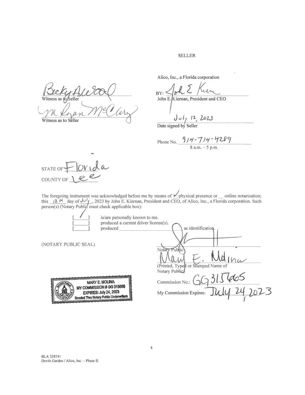
eller Witness as to Sailer SELLER Alico, Inc., a Florida corporation BY: /it John E. Kiernan, President and CEO 3u17 11' lo1.3 Date signed by Seller Phone No. 11-7)2/- 1227 8 a.m. — 5 p.m. STATE OF COUNTY OF The foregoing instrument was acknowledged before me by means of 'physical presence or online notarization; this j2- ti day of J-3y , 2023 by John E. Kiernan, President and CEO, of Alico, Inc., a Florida corporation. Such person(s) (Notary Publi must check applicable box): rr (NOTARY PUBLIC SEAL) BLA 328741 Devils Garden / Alico, Inc. — Phase II is/are personally known to me. produced a current driver license(s). produced 8 Nota as identification (Printed, Type or S amped Name of Notary Pub CCommission No.: My Commission Expires: I 3 1 De(06 "2,3
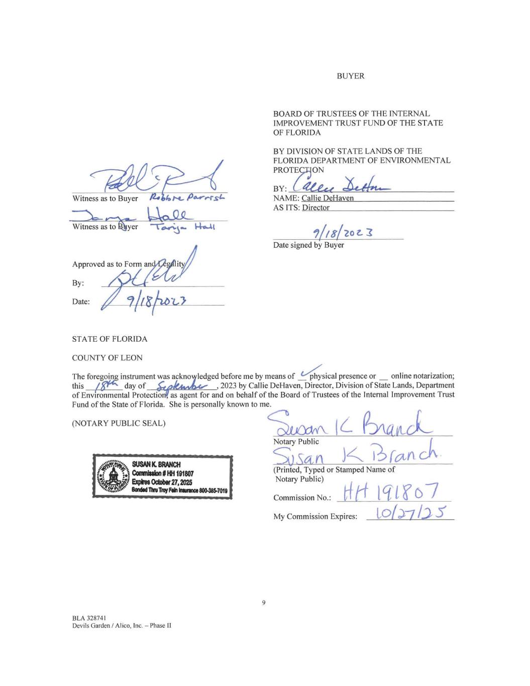
Witness as to Buyer Witness ase-tOlgi; Approved as to Form an ity By: it Date: STATE OF FLORIDA COUNTY OF LEON BUYER BOARD OF TRUSTEES OF THE INTERNAL IMPROVEMENT TRUST FUND OF THE STATE OF FLORIDA BY DIVISION OF STATE LANDS OF THE FLORIDA DEPARTMENT OF ENVIRONMENTAL PROTEON BY: Aete—e. NAME: Callie DeHaven AS ITS: Director 17/8/20 3 Date signed by Buyer The foregoing instrument was ackno ledged before me by means of _ physical presence or online notarization; this day of , 2023 by Callie DeHaven, Director, Division of State Lands, Department of Environmental Protection as agent for and on behalf of the Board of Trustees of the Internal Improvement Trust Fund of the State of Florida. She is personally known to me. (NOTARY PUBLIC SEAL) 9 BLA 328741 Devils Garden / Alico, Inc. — Phase II Sito IL Q-D,‘„,,t Notary Public SanK Pfv (Printed, Typed or Stamped Name of Notary Public) Commission No.: f(I4 Ig11.67 My Commission Expires: toia-71.25'
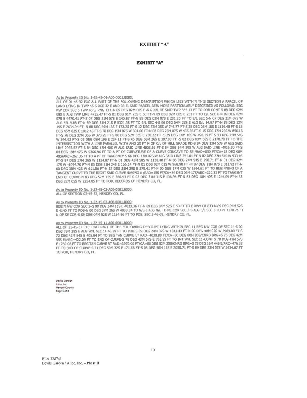
EXHIBIT "A" EXHEIBIT"A" 8.i,10,Et012alt(.10.110.-1.-.32....-15-01-A00-0001.0000: All OF 01-45-32 EXC ALL PART OF THE FOLLOWING DESCRIPTION WHICH LIES WITHIN THIS SECTION A PARCEL OF LAND LYING IN TWP 45 5 RGE 37 E AND 33 Er SAID PARCEL BEIN MORE PARTICULARLY DESCRIBED AS FOLLOWS: BEG • COR SEC 6 TWP 45 S, RNG 33 EN 89 DEG 02M 085 E ALG N/L. OF SAID TWP 353_13 FT TO P08-CONT N 89 DEG 02M 085 E ALG TWP LINE 4735.47 FT-5 01 DEG 01M 23$ E 50 FT-N 139 DEG 02M 085£ 251 FT TO E./L SEC 6-N 89 DEG 02/4 07$ E 4470.41 FT-5 07 DEG 21M 075€ 140.87 Fr-N 89 DEG 0211 075 E 201.25 FF TO E/L SEC 5-N 07 DEG 21M 075W ALG E/L. 9,88 ET-N 89 DEG 31M 21S E 5321.38 FT TO Eft. SEC 4-S 06 DEG 54M 28$ E ALG E/I. 14.97 FT-N 89 DEG 12M 155 £2634.94 FT -N 88 DEG 59M 188 E 173.25 FT-5 12 DEG 5314 355 W 746.77 FT-S 28 DEG 034 105£ 1136,48 FT-S 33 DEG 4514 025£ 1012.43 FT-S 78 DEG 1514 075 W 601.06 FT-N 83 DEG 2314 075 W 435,36 FT-S 15 DEG 1714 288W 896.16 FT-S 78 DEG 3714 355W 370.95 FT-5 00 DEG 52M 355 E 236.32 FT -5 29 DEG 14M 105W 496,15 FT-5 13 DEG 2514154$ W 344..63 FT-SOS DEG 09M 195£ 224.11 FT-S 45 DEG 56M 265 E 397,03 FT -802 DEG OOM 588 E 2170.78 FT TO THE INTERSECTION WITH A LINE PARALLEL WITH AND 30 FT N OF CIL OF HILL GRADE RD-5 84 DEG 1314 835 W ALG SAID LINE 2925,52 FT-5 84 DEG 17M 40S W ALG SAID LINE 4003.61 FT-5 84 DEG 1414 395 W ALG SAID LINE -4916.30 FT-5 .841 DEG 1914 475 W 5266,96 FT TO A Fr OF CURVATURE OF A CURVE CONCAVE TO SE /RAD.830 FT/CA-18 DEG 06M 40S/ARC.,262,36 FT TO A PT OF TANGENCY-5 66 DEG 13M 075W ALG SAID LINE 251.01 FT-N 02 DEG 2714545W 933,16 FT-5 87 DEG 5714 365 W 1134.07 FT-N 01 DEG 43M 588W 1138_48 FT-N 86 DEG 2414 54S E 298.71 FT-N 01 DEG 4214 175W -1094/0 FT-N 85 DEG 21M 245 E 166.14 FF-N 01 DEG 021401$ W968,90 FT -N 87 DEC 111407$ E 311.92 Fr-N CO DEG 3814 475 W 611.56 FT-N 87 DEG 3514 295 E 379_41 FT-N 00 DEG 1714 025 W 1914.61 FT TO BEGINNING OF A TANGENT CURVE TO THE RIGHT SAID CURVE HAVING A /RADv.= 150 FT/CA..134 DEG 0914 175/ARC.220.32 FT TO TANGENT END OF CURVE-N 83 DEG 52/1 155 E 766,53 FT-5 02 DEG 3114 315 E 136.96 FT-N 63 DEG 18M 408 E 1244.09 FT-N 33 DEG 2214 OSS W 2254.85 PTV POB, RECORDS OF HENDRY CO, FL. As to ProDertv ID No. 1-32-45-0244.00-0001,0000: ALL OF SECTION 02.-45-32, HENDRY CO, FL. .62..42..ENIPC91a045-03-A0D-000I.000.0: BEGIN NW COR SEC 3-5 OD DEG 3414 115 E 403136 FT-N 89 DEG 0414528 E 50 FrTO E RWY CR 833-N 89 DEG 0414525 4140 FT TO P013-N 00 DEG 371426$ W 4033,34 TO N/L-E ALG N/L TO NE CDR SEC 3-5 ALG Eil. SEC 3T0 FT 127826 FT N OF SE COWS 89 DEG 04M 525W 1134,96 FT TO POB, SEC 345-32„ HENDRY CO, PL yjoperty ID No, 1-32-45-11-A00-0801.0000: ALL OF 11-45-32 EXC THAT PART Of THE FOLLOWING DESCRIPT LYING WITHIN SEC 11 BEG NW COR OF SEC 14-500 DEG 7914 285 E ALG W/L SEC 14 46.39 FT TO P013-5 89 DEG 2414 375 W 1513,43 FT-N 00 DEG 4014 025 W 2969.00 FT-5 72 DEG 4214 545 E 405,84 FT TO BEG TAN CURVE LT RAD=1030.00 FT/CA=06 DEG OOM 035/CHRD BRG=5 75 DEG 4214 555 E/ARC=422.09 FT TO END OF CURVE-5 78 DEG 4714 575 E 765-55 FT TO 1NIT W/L SEC 11-CONT 578 DEG 4714 575 E 1760.08 FT TO BEG TAN aiRvE RT RAD.3970,00 FT/CAP306 DEG 52M 25S/CTIRD BRG,..S 75 DEG 1614 445 E/ARCv476.28 FT TO END Of CURVE'S 71 DEG 50M 325£ 171.68 FT-SOB DEG 50/1 115 E 205521 FT-S 89 DEG 2314 078W 2634.67 FT TO P08, HENDRY CO, FL twnik glimaatn Aria,. Rm. ~wiry Owl., vtib•e 1 or A 10 BLA 328741 Devils Garden / Alico, Inc. - Phase II
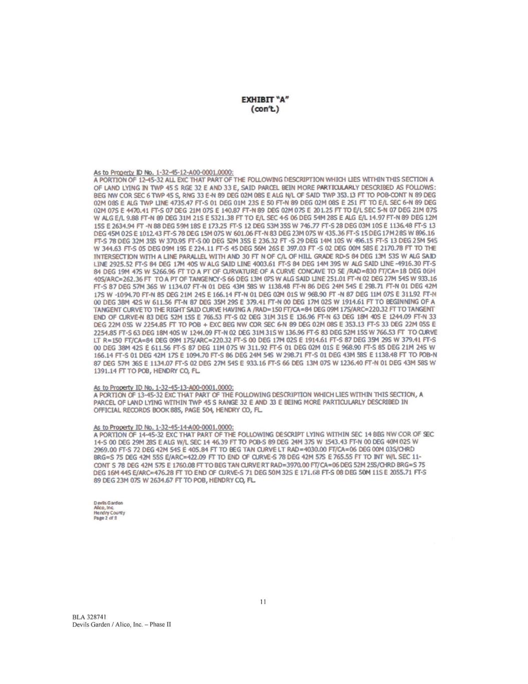
EX>IIB1T (con) Ås to PrcoetLy ID No. 1-32-45-12-400-0001.0000: A PORTION OF 12-4542 AU. EXC THAT PART OF THE FOLLOWEIG ricsournoN mnal LIES WITHINTHES SECT1014 A OF u4110 LYING TVVP 455 RGE 32 E AND 33£. SAID FARGE'. BEIN MORE PARTR~Y CESCRIDED AS FOLLOWS: DEG MV COR SEC 6 TWP 455, RNG 33 E41 89 DEG 0214085£ALG N/1. Cf SA1D IWP 353.13 FT10 P08-03NT 1189 DEG 02M 085 E ALG -MP UNE 4735.47 ET-5 01 DEG 01M 23.5 E 50 Fr-N 89 DEG 0214 08.5 E 251 Fr -N) Eit. SEC 6-N 89 DEG 02M 075 E 4470.41 FTS 07 DEG 2114 075 E 140.87 FT-N89 DEG 02M 075 E 20125 rr TO SEC S-N 07 DEG 2114015 W /41.G EfL 9.88 FT4I 89 DEG 3114215 E 5321.38 FT TO [FL SEC 45 06 DEG 5414 285 E KG [IL 14.97 Fr-N 89 DEG 1211 15$ E2634.94 FT 41138 DEG 59M 185 [17315 FT-5 12 DEG 53M 355 W 74637 ET-5 28DEG 03M 105 E 1136.48 FT-5 13 DEG 424 025 E 1012.43 FTS 78 DEG 191 075 W 601.06 Ff-N 83 DEG 2314 075 W 435.36 Frs 15 DEG 17M 285 W 9)6.16 FT-5 78 DEG 3214 355 W 370.95 Frs 00 DEG 52M 35$ E 236.32 Fr -5 29 DEG 1414185 W 496.15 Fr-5 13 DEG 2511 545 W 344.63 FT-SOS DEG 0914 195 [224.11 ET-5 45 DEG 5614 265 E 397.03 FT -S 02 DEG OOM 585 E 2170.78 FT TO /1HE INTERSECTION WITH A LINE PARALLEL WITH AM) 30 FT N OF C/L OF HILL GRÅDE RDS 84 DEG 191 53$ W MG SÅD LDE 2925.52 FT-5 84 DEG 171440$ WALGSMDLINEI003.61 FTS 84 DEG 1414 395 W SAID LINE -4916.30 FIS 84 DEG 19114 475 W 5266.96 Fr TO A Fr Of CURVATURE OF A CURVE 0:»ICAvE TO SE MAD=830 Fr/CA=18 DEG 06M 405/ARC.,=262.36 FT TOA Pr OF T»IGENLY-5 66 DEG 13/4 07$ W MG SAID LINE 251.01 FT-11 02 DEG 2714 545 W 933.16 FT-5 87 DEG 5714 365 W 1134.07 FT-N 01 DEG 4311 585 W 1138.48 FT-11 86 DEG 2411 545 E 251.71 FT-ti 01 DEG 4214 175 W -1094.70 FT-ti 85 DEG 2114 245 E 166.14 FT-ti 01 DEG 0714 015 W 9E8.90 FT -N 87 DEG 1114 075 E 31L92 FT-FLI 00 DEG 38/4 425 W 611.56 FT-441 87 DEG 3514 295 E 379.41 FT-11 00 DEG 1714 02.5 W 1914.61 Fr TO EEG-LINNING OF A TANGENT OURVET011-E RIGHT SAID CURVE HÅVING A fRAD=150 F170k=84 DEG 0914 175/ARC=220.32 FTTO TANGENT END Of CURVE-N 83 DEG 5214 155 E 766.53 FT-5 02 DEG 3114315 E 136.96 FT-ti 63 DEG 184 405£ 1244.09 FT-ti 33 DEG 2214 0 W 2254.85 Fr TO POD 4- EXC DEG NW SEC 644 89 DEG 0214 085 E 353.13 FT-5 33 DEG 2214055 E 2254.85 FT-5 63 DEG 1814 405 W 1244.09 FT-ti 02 DEG 3111 315 W 116.96 FT-5 83 DEG 521415$ W 76633 FT TO CURVE ur R=150 FrXA=84 DEG 0911 175/ARC=22032 FT-5 00 DEG 17M 02$ E 1914.61 FTS 87 DEG 394 29$ W 379.41 FT-5 00 DEG 3814 425 E 611.56 FT-5 87 DEG 3.114 075 W 311.92 FTS 01 DEG CQM 015 [968.90 Fr-5 85 DEG 2114 245 W 166.14 Fr-5 01 DEG 4214 175 E 1094.70 FT-5 86 DEG 2414 545 LV 298.71 FT-5 01 DEG 4314 585 E 1138.48 FT TO P0841 87 DEG 5714 365 E 1134.07 FT-5 02 DEG 27M 545 E 93116 Fr-s 66 DEG 1311 075 W 1236.40 FT-11 01 DEG 431158$ W 1391.14 FT TO PM, HENDRY CO, FL As to Prooertv ID No. 1-32-45-134400-0001.0000: A PORTION OF 13-45-32 EXC THAT PART Cf THE FOLD:MI/1G tesamioN WHICH LIES1411-11111111415 SECTION„ A PARCEL OF LAND LYDIG WITHIN INVP 45 S RANGE 32 ENID 33 E DENG MORE PARTICUIARJLY DESCRIBED IN OFFICIAL RECORDS 8001(885, PÅE 504, HENG« CO, FL As to Proper/y ID No. 1-32-45-14400-0001.0000: A PORTION OF 1+45-32 EXCTHAT PART OF THE FOLLOWING DES(RIPT LYING WITHIN SEC 14 DEG NW COR OF SEC 14-500 DEG 2914295 [MG W/1. SEC 1446.39 FTTO POP-5 89 DEG 2414 375 W 1543.43 Fr-N ce DEG 4011 02$ W 2968.00 FT-5 n DEG 4214 545 E 405.84 Fr TO DEG TAN CURVE LT RAD =4030.00 FT/CA=06 DEG 0011 035/MID EIRG=S 75 DEG 4211 555 E/ARC=422.09 Fr TO E1413 OF OJRVES 78 DEG 4214 575 E 76155 FT TO INT Witi. SEC 11- CONT S 78 DEG 4214 575 E 1760.08 ETT° EIEG T»I CURVE RT RÅD=3970.0D FT/C.A=06 DEG 5214 2.55/CHRO BRG=5 75 DEG 16M 445 EjAR04476.28 FT TO END CF CURVES 71 DEG SOM 32$ E 171.68 FT-5 00083 SOM 115 E 2055.71 Fr-s 89 DEG 2314075 W 2634.67 FTIO POD, HilDRY CO, FL. er9sGareen Akk Inc Herrfty Catroltv Pa fe 2 dfll 11 BLA 328741 Devils Garden / Al ico, Inc. - Phase II
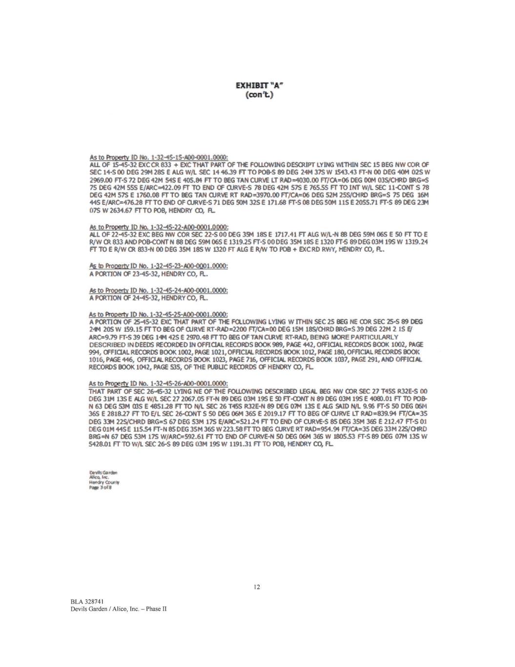
EXHIBIT (cont) As to Property ID No. 1-3245-15400.01101.0000: ALL OF 15-45-32 EXCCR 833 + DIC THAT PART OF THE FO~IG DESCRIPT LYING WITHIN SEC 15 BEG NW COR OF SEC 14-5 00 DEG 29M 28S E ALG WiL SEC 14 4639 nTo MSS 89 DEG 2414 37S W 1543.43 FT-14 00 DEG 40M 025W 2969.00 Fr-5 72 DEG 4214 545 E 405.81 Fr TO BEG TAN CAVE LT RAD =4180.00 F17CA.06 CEG 0014 0351CHRD 8RG=S 75 DEG 4211555 E/ARC422.09 FT TO Et«) OF CURVE-S 78 DEG 4214 575 E 76555 Fr TO my. w/L SEC ii-comr s 78 DEG 4214575 E 1760.08 FT TO BEG TAN OJRVE RI RAI)4970.00 FT/Ck--06 DEG 5211 25S/OiRD 8RG=5 75 DEG 1611 445 E/ARC=476.28 FI-TO END OF CURVES 71 DEG SOM 325 E 171.68 FT-S 08 DEG SOM 115 E2055.71 FT'S 89 DEG 231 075 W 2634.67 FrTO P08, NEWRY CO, R. As to Property ID No. 1-32-45-22-A00-0001.0000: ALL OF 22-45-32 EXC BEG NW COP SEC 22-S 00 DEG ISM 18S E 1717.41 FT ALG W/L-11 88 DEG 5914 06S E 50 FT TO E IL/W Ot 833 AND P08-CONT N 88 DEG 5914 06S E 1319.25 FTS 00 DEG 3514 185 E 132011-S 89 DEG 03M 195W 1319.24 Fr TOE 11./W Ok 813-N 00 DEG 35/4 185W 1320 Fr MG E Ft./W1O FOB + EXCRD RVVY, HENDRY CO, FL. As to Fto0e/lv ID No. 1-32-45-23-A00-0001.0000: A PCRITON OF 23-45-32, HENDRY CO, FL. As to Property 10 No. 1-32-45-24-.400-0001.0040: A PCR11ON OF 24-45-32, HENDRY CO, R.. As to Property ID No. 1-32-45-25-A00-0001.0000: A PCRTICN OF 25.45-32 EXC THAT PART OF THE FOLLOWING LYING WITHIN SEC 25 BEG NE COP SEC 25-589 DEG 244 205 W 159.15 FT TO DEG OF CURVE RT-RAD=2200 FTACA00 DEG 1514 185/ORD BRG=5 39 DEG 22M 215 E, ARO*9.79 FT-S 39 oeG 144 425 E 2970.48 FTTO BEG Of TAN CURVE RT-RAD, BEING MORE PARTICULARLY DESCRIBED IN DEEDS RECORDED IN OFFICIAL RECORDS BOOK 989, ME 442, OFFICIAL RECORDS BOOK 1002, PACE 994, OFFICIAL RECORDS 800K 1002, PAGE 1021, OFFICIAL RECORDS 800K 1012, PAGE 180, OFFICIAL RECORDS gook 1016, WE 446, OFFICIAL RECORDS 800K 1023, PAGE 716, OFFICIAL RECORDS BOOK 1037, PACE 291, AND OFFICIAL RECORDS #100K 1042, PAGE 535, OF THE P1,18110 RECORDS OF HENDRY CO, FL. As to ne3 ID No. 1-32-45-26-A00-0001.0000: THAT PART OF SEC 26-45-32 LYING NE OF THE FOLLOWING DESCRIBED LEGAL BEG NW COP SEC 27 1455 R.32E-S 00 DEG 3114 135 E ALG Wit. SEC 27 2067.05 FT-N 89 DEG 0314 195 E 9) FT-COAIT N 89 DEG 0314 195 E 40E0.01 Fr TO PO8- N 63 DEG 5314 C85 E 485128 FT TO Nit SEC 26 T455 R32E-N 89 DEG 07M 13S E MG 54410 NIL 9.96 Frs 50 DEG 0614 36.5 E 2818.27 Fr TO Et SEC 2ErCO1'iT S 50 DEG 0611 365 E 2019.17 Fr TO DEG OF OJRVE IT RAD=839.94 FT/C.Ame35 0(6 334 22S/CHRD EIRGftS 67 DEG 5314 175 E/ARCefg52124 n TO END OF CURVE-5 85 DEG 394 365 E 21247 FT-SOl DEG 0114 445E 11534 FT-N 85050 35M 365 W22338 FTTO EEG CURVE RTRAD=954.94 FrICA=35 DEG 33M 225/08t0 8RG 44 67 0(0 5314 os W/ARC4592.61 F1 TO END OF CURVE44 50 DEG 0614 36S W 180533 rrs 89 DEG 0714 135W 5428.01 FT -TO WA. SEC 26-5 89 DEG 0314 19S W 1191.311110 F08, HENDRY CO, FL leinitairden Ake, Wresdr7 CouYi, oit6 12 BLA 328741 Devils Garden / Alico, Inc. — Phase II
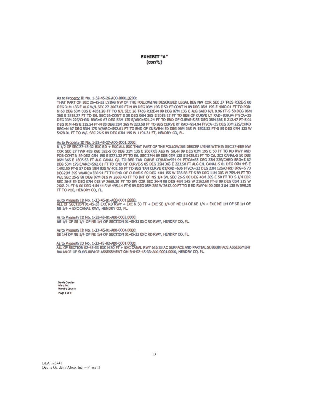
MIMT *A" (amt) As to Prooetly ID No. 1-32-45-26-A00-00010200: DtAT PART OF SEC 26-45-32 LYNG NW OF THE FOILLOWING DESCREIM LEGAL EEG 1.1iN 03R SEC 27 T455 R32E-5 00 DEG 3114 135E PLG W/L SEC 27 2067.05 FT-N 89 DEG 0314 19$ E 50 FT-CONT N 89 DEG 03/4 19$ E 4080.01 FT TO POB- N 63 DEG 5311 03S E 4851.28 FT TO N/L SEC 26 T45S R32E-4 89 DEG 0714 135 E ALG SAM N/L 9.96 FT-S 50 DEG 06/4 365 E 2818.27 FT 11;) E/.. SEC 26-CONT S 50 DEG 0611365 E 2019.17 FT TO REG CF CURVE IT RAD=839.94 FI7CA-35 DEG 33/4 22~1) BRG=S 67 DEG 5311175 E/PRCe521.24 FT TO 841) OF CURVE-S 85 DEG 324 365 E 212.47 FT -S01 DEG 0114 445 E 11534 FT-N 85 DEG 351136$ W22338 FT TO BEG CURVE RT RAD=954.94 FT/Ole---35 DEG 33M 22.5,04t0 EIRGeN 67 DEG 5314175 W/ARO--592.61 FT TO DID OF CURVE-N SO DEG 061436$ W 180533 FT-S 89 DEG 07M 135W 5428.01 FT TO W/L SEC 26-5 89 DEG 0314 195W 1191.31 FT, HENORY CO, FL As to Prottertv ID No. 1-32-45-27-A00-0001.0000: N 1/2 OF SEC 2745-32 EXC RO D1C ALL EXC THAT PART OF THE FCLLOW1NG MSCRP LY1NG WTTNIN SEC 27-0EG NW CCR SEC 27 TWP 45S RC£ 32E-S 00 CEG 3114 13S E 2067.05 ALG W S/L-N 89 DEG 03M 19S E 50 FT TO RD RWY MD POB-CONT N 89 DEG 0314 19$ E 5271.32 ETT() E/1 SEC 2741 89DC-G 0714 135 E 5428.01 Fr 10 dL2C2 CANAL-S 50 MG 061136$ £180533 FT ALG CANAL CX TO BEG TAN CURVE LT/RAD454.94 FT/CA-45 DEG 33/4 22.5/01RD BRG2.-S 67 DEG 53/4 175 E/ARC=592.61 FT TO END OF CUPVE-S 85 DEG 394 365 E 223.58 FT ALG C/t. CANAL-S 01 DEG 0611 E 1492.50 FT-S 57 DEG 1811 03$ W 402.50 FTTO BEG TAN CURVE RT/RAD35 FT/CA=32 DEG 2111 12S/CHRD BRG'S 73 DEG294 395 W/ARC.---358.94 FT TO END OF CURVE-5 89 DEG 4111 1.55 W 78538 FT-S 89 DEG 1114306 W 759.44 Fr ir) Witt. SEC 25-S 89 DEG 07M 01S W 2668.43 FT TO 1NT OF NS 1/4 Sil SEC 26-S 00 DEG 46M 305 E 50 Ff 10 S 1/4 COR SEC 26-S 89 DEG 0711 015W 2668.30 FT TO SW COR SEC 2641 00 DEG 48/4 54S W 2162.60 Fr-s 89 DEG 0514 11S W 2663.21 FT-N 00 DEG 41M 44 S W 495.14 FT-S 89 DEG 05/4 28S W 2612.00 FTTO E RD RWY-N 00 DEG 31M 13$ W598,25 FT TO PM, HENDRY CO, FL., .I to Proit ID No. 1-3245-Q1-A " *0001 ALL GF 9~o1-45-33 ExCRD-gWY 4- EXC N 50 FT EXC SE 1/4 Of NE 1/4 OF NE 1/4 EXC NE 1/4 OF SE 1/4 OF NE 1/4 EXCCANAL RWY, HENDRY CO, FL Ps to Pro txtw ID No. 1-33-45-01-A00-0003.0000: NE 1/4 CF SE 1/4 OF NE 1/4 OF SECttON 0145-33 EXC RO RWY, HENDRYCO, FL As to Prooecly ID No, 1-3345-01-A00-0004,0000: SE 1/4 OF NE 1/4 OF NE 1/4 OF SECTICM 0145-33 ExC RO RWY, HENDRY CO, FL As to PrOtlet1Y ID No. 1-3345-02~1.0000: ALI. OF SECTION 0245-33 EXC N 50 FT + EXC CANAL RWY 616.83 AC SURFACE AND PARTIAL SUBSURFACE ASSESSMENT BALANCE CF SUBSURFACE ~le« ON R-fr0245-33-A004001.0000, tr-ENDRY CO, FL Dekeli Gl•dan let Heft* y r.iJtmty Pabeci 13 BLA 328741 Devils Garden / Alico, Inc. - Phase II
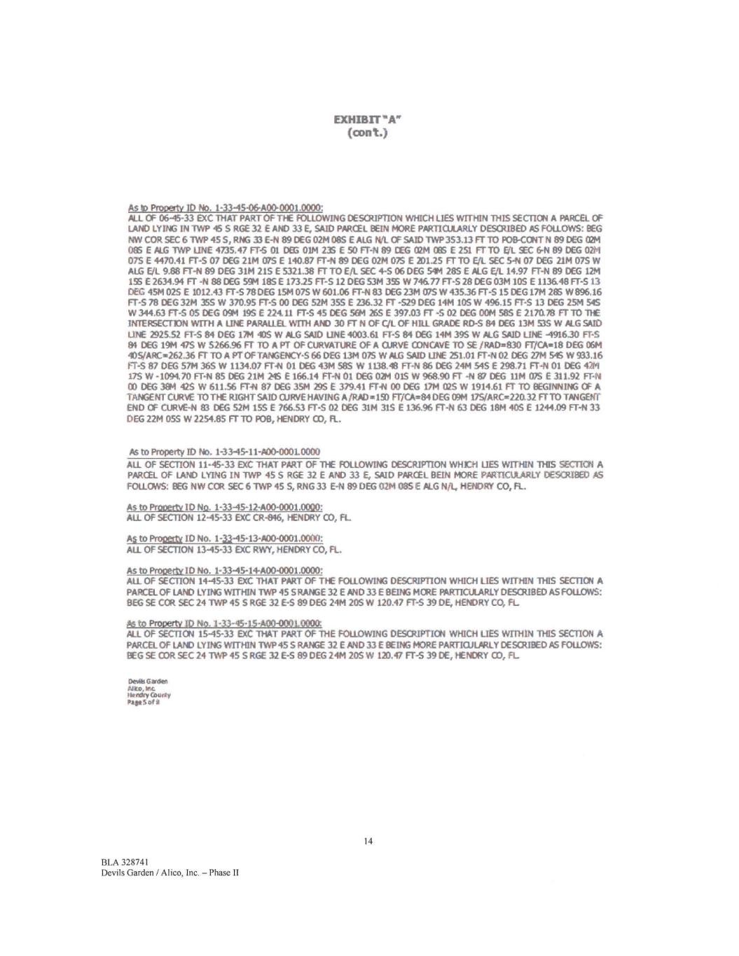
EXHIBIT (cont.) As to Prooertv ID No. 1-33-45,06-A00-0001.0000: ALL OF 06-45-33 EXC THAT PART OF THE FOLLOWING DESCRIPTION WHICH LIES wrnivi THIS SECTION A PARCa OF LAND LYING IN TWP 45 S RGE 32 E AND 33£, SAID PARCEL BEIN MORE PARTICULARLY DESOUBED AS FOLLOWS: BEG NW COR SEC 6 'TWP 455, RNG 33 E441 89 DEG 0211085 E ALGIWL OF SAID TWP 353.13 FT TO FOB-CCNTN 89 DEG 02M 085 C MG TWP LINE 4735.47 FTAS 01 003 0111 23S E 50 FT-N 89 CEG 02M CGS E 251 FT 70 En. SEC 6-N 89 DEG 02M 075£ 4470.41 FT-S 07 DEG 2111 075 E 140.87 FT-N 89 DEG 0214 075 E 201.25 rrro EA_ SEC 5-N 07 DEC 2114 015W ALG Eli 9.88 FT-N 89 DEG 3114 215 E 532138 Fr TO Eft SEC 4-S 06 DEG 5414 285 E ALG Eel 14.97 Fr-N 89 DEG 1214 15S £2634.94 FT 44 99 DEG 5914 18S E 17325 Fr-s 12 DEG 53M 385 W 746.77 Fr-S 28 DEG 0314 105 E 1136,48 FT-S 13 DEC 451102S E 1012.43 FT-S 78003 1514 07S W 601.06 FT-N 83 DEG 2314 COS W 43536 FT-S 1$ DEC 1714 285 W896,16 FT-S 78 DEG 3211 355 W 370.95 FT-S 00 DEG 5214 355 E 236.32 FT -529 DEG 1414 10S W 496.15 FT-S 13 DEG 25/4 545 W344.63 FT-S OS DEG OIM 195£ 22441 FT-S 450(5 564 26SE 397.03 FT -S 02 DEG 0011 585 E 217a78 FT 10 TIE INTEFSC-CTION WITH A LINE PARALLEL WITH MID 30 FT N OF CIL OF HILL GRADE RD-5 84 DEG 1314 535W ALG SAID LINE 2925.52 FT-S 84 DEG 1714 405 W PLC SAID LINE 4003.61 FT-S 84 DEG 1414 395 W PLC SAID IDE 491630 FT-S 94 DEG 1914 475W 5266.96 FT TO A PT OF CURVATURE OF A °AVE CONCAVE 70 SE /RAD2E830 FIKA•18 DEG 0611 40S/ARC-262.36 F7 TO A PT OFTANGENCY-S 66 DEG 1314025 W ALG SAID LINE 251.01 FT-NO2 DEC 2714545 W933.16 FT-S 87 DEG 57M 365 W 1134.07 FrA 01 t)EG 4314 585 W 1138.48 FT-N 86 DEG 2414 545 £298.71 FT-N 01 0(5 4214 17S W -1094.70 FT-N 85 DEG 21M 24S E 166.14 FT-11 01 DEG 0214 OIS W 968.90 Fr -N 61 OEG I1M E 311.92 F144 CODES 394 475 W 611.56 FT-N 87 DEG 3514 29S E 379.41 FT-N CODES 1714 025 W 1914.61 FT TO BEGINNING CP A TANGENT CURVE TO THE RIGHT SAID CURVE HAVING A/RAI:1015D FT/04-84 DEC 0914 175/AROE22a32 FTTO TANGENT END OF CURVE44 63 DEG 52M 15S E 766.53 FT-S 02 oeo 31M 31S E 136.96 FT-14 63 DEG 18M 40S E 1244.09 FT-N 33 DEC 2214 055 W 2254.85 FT TO P08, HENDRY CO, FL. As to Property ID lb. 1-33-45-11-A00-000L0000 ALL OF SECTION 11-45-33 EXC TfiA7 PART OF TILE FOLLOWING DESCRIPTION WHEN LIES WITHIN THIS SECTION A PARCEL OF LAND LYING IN 1WP 45S RGE 32 E AM) 33 E. SAID PARCEL BEIN MORE PARTICULARLY DESCRIBED AS FOLLOWS: BEG NW COR SEC 6 1WP 45S, RNG 33 E-N 89 DEG 0211085£PEG NfL, HENDRY CO. FL. As to Propetty ID No. 1-33-45-12-A00-0001.0000: ALL OF SECTION 1245-33 EXC C4-046, HENDRY CO, FL As to Pro= ID No. 1-33-45-13-A00-0001.00)0: ALL OF SECTION 13-45-33 EXC RWY, HENDRY CO, FL. As to Proceth ID No. 1-3345-14-A00-0001.0000: ALL OF SECTION 14-45-33 OCC 'THAT PART OF THE FOLLOWING DESCRIPTION WHICH LIES WITHIN This SECTION A PARCEL OF LAND LYING WITHIN TWP 455 RANGE 32 E AND 33£ BEING MORE PARTICULARLY DESCRIBED AS FOLLOWS: BEG SE COR SEC 24 TWP 455 RGE 32£-S BODES 2414 205 W 120.47 FT-S 39 DE, HENDRY CO, FL As to Prooertv VD No. 133-45-15-A00-00(4,0000 ALL OF SECTION 1545-33 exc THAT PART OF THE FOLLOWING DESCRIPTION WHICH LIES WITHIN THIS secnoN A PARCEL OF LAM) LYING WITHIN 7WP 45 S RANGE 32£ AND 33£ BEING MORE PARTIOJUIRLY DESCRIBED AS FOLLOWS: BEG SE COR SEC 24 TWP 45 S RGE 32 E-S 89 DE'G 24M 20S W 120.47 FT-S 39 DE, HENDRY CO, FL. Devils Garden Nits, lei Pleating Quay Page seta 14 BLA 328741 Devils Garden / Alico, Inc. - Phase II
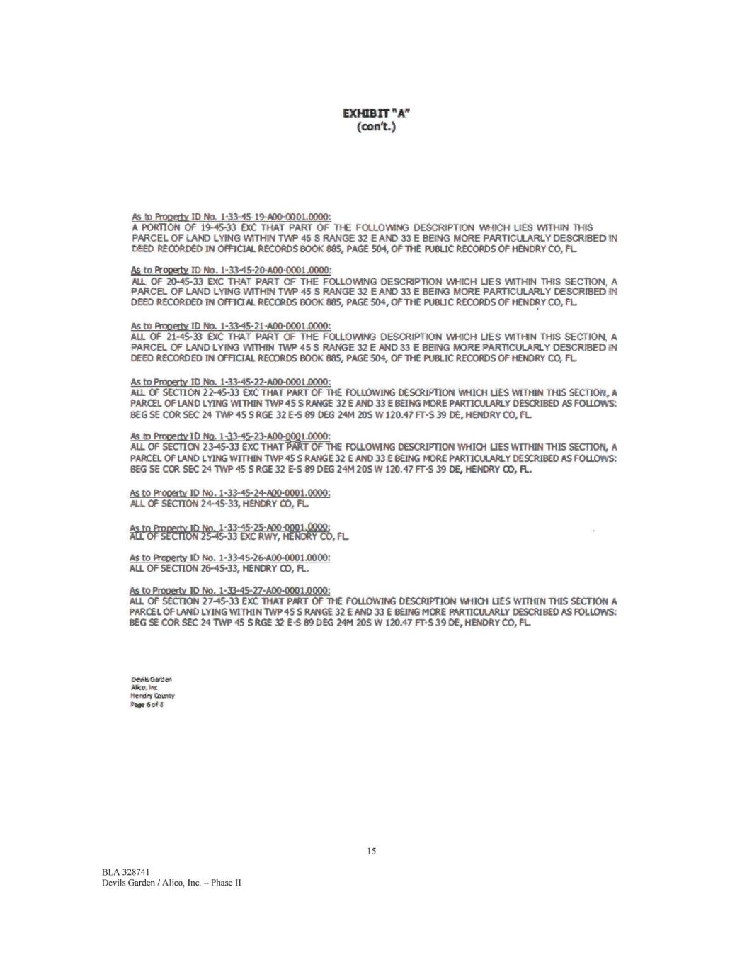
EXHIBIT "Pey (cont.) As ID Rooetty ID No. 1-33-46-19-A00-000L0000: A PORTION OF 19-45-33 EXC THAT PART OF TI-E FOLLOWING DESCRIPTION WHICH UES WITHIN 11-08 PARCEL OF LAND LYING WITHIN TWP 455 RANGE 32 E AND 33 E BEING MORE PARTICULARLY DESCRIBED IN DEED RECORDED IN OFFICIAL RECORDS BOOK 885, PAGE 504, OF THE PUBLIC RECORDS OF HENDRY CO, PL. Uto Progedx ID No. 1-33-45-20,400-0001.0000: AI OF 20-45-33 EXC THAT PART OF THE FOLLOWING DESCRIPTION WHICH LIES WM-tIN THIS SECTION, A PARCEL OF LAND LYING WITHIN TWP 455 RANGE 32 E AND 33 E BEING MORE PARTICULARLY DESCRIBED IN DEED RECORDED IN OFROPL RECORDS BOOK 885, PAGE 504, OPTIC PUBIIC RECORDS OF HENDRY CO, FL As to Prooetlic ID No. 1-3345-214i00-0001.0000: AU. OF 21,45-33 EXC THAT PART CC THE FOLLOWING DESCRIPTION WHICH LIES WITHN THIS 8EG-riot* A PARCEL OF LAND LYING WITHIN 'TWP 455 RANGE 32 E AND 33 E BEING MORE PARTICULARLY DESCRIBED IN DEED RECORDED IN OFFICIAL RECORDS BOOK 885, PAGE 504, OF THE PUBLIC RECORDS OF HENDRY CO, FL As to Prooerty ID No. 1-33-45-22-A80-0001.0000: AU. OF SECTION 22-45-33 EXC THAT PART OF THE FOLLOWING DESCRIPTION IM1101 LIES WITHIN THIS SECTION, A PARCEL OF LAND LYING WITHIN TWP 45 S RANGE 32 E AND 33£ BEING MORE PARTICUIARLY DESCRIBED AS FOLLOWS: BEG SE COR SEC 24 11A0 45 S RGE 32 E-5 89 DEG 2411 20S W120.47 FT-S 39 DE, HENDRY CO, FL As 10 ProCed)(10 NO. 1-33-45-23-A001021.0000: ALL OF SECTION 23-45-33 EXC THAT PART OF THE FOLLOWING DESCRIPTION WHICH LIES WITHIN THIS SECTION, A PARCEL OF LAND LYING WITHIN 1WP 45 S RANGE 32 E AM) 33£ BEING MORE PARTICULARLY DEXRIBED AS FOLLOWS: BEG SE CCR SEC 24 1WP 45S RGE 32 E-S 89 DEG 2414 205 W 120.47 FT-S 39 DE, HENDRY CO, FL. As to Wooetly ID No. 1-33-45-24-A00-0801.0000: ALL. OF SECTION 24-45-33, HENDRY 03, FL • gtodimittarac-1:40 It11-11.1" p- • As to Primerty ID No. 1-3345-26-A00.0001.0000: ALL OF SECTION 26-45-33, HENDRY CO, FL. As to Prooatt ID No. 1-33-45-27-A00-0001.0000: AU. Of SECTION 27-45-33 EXC THAT PART OF 11-E FOLLOWING DESCRIPTION WHICH LIES WIIHIN THIS SECTION A PARCEL OF LAND LYING WITHIN TWP 4S S RANGE 32£ AND 33£ BEING MORE PARTICULARLY DESCRIBED AS FOLLOWS: BEG SE COR SEC 24 TWP 45 S RGE 32 E4 89 DEG 24/4 205 W 120.47 m839 DE, HENDRY CO, FL Ger% aprdet Aka. Ave Heide, rinenty Pp* cif 8 15 BLA 328741 Devils Garden / Alico, Inc. — Phase II
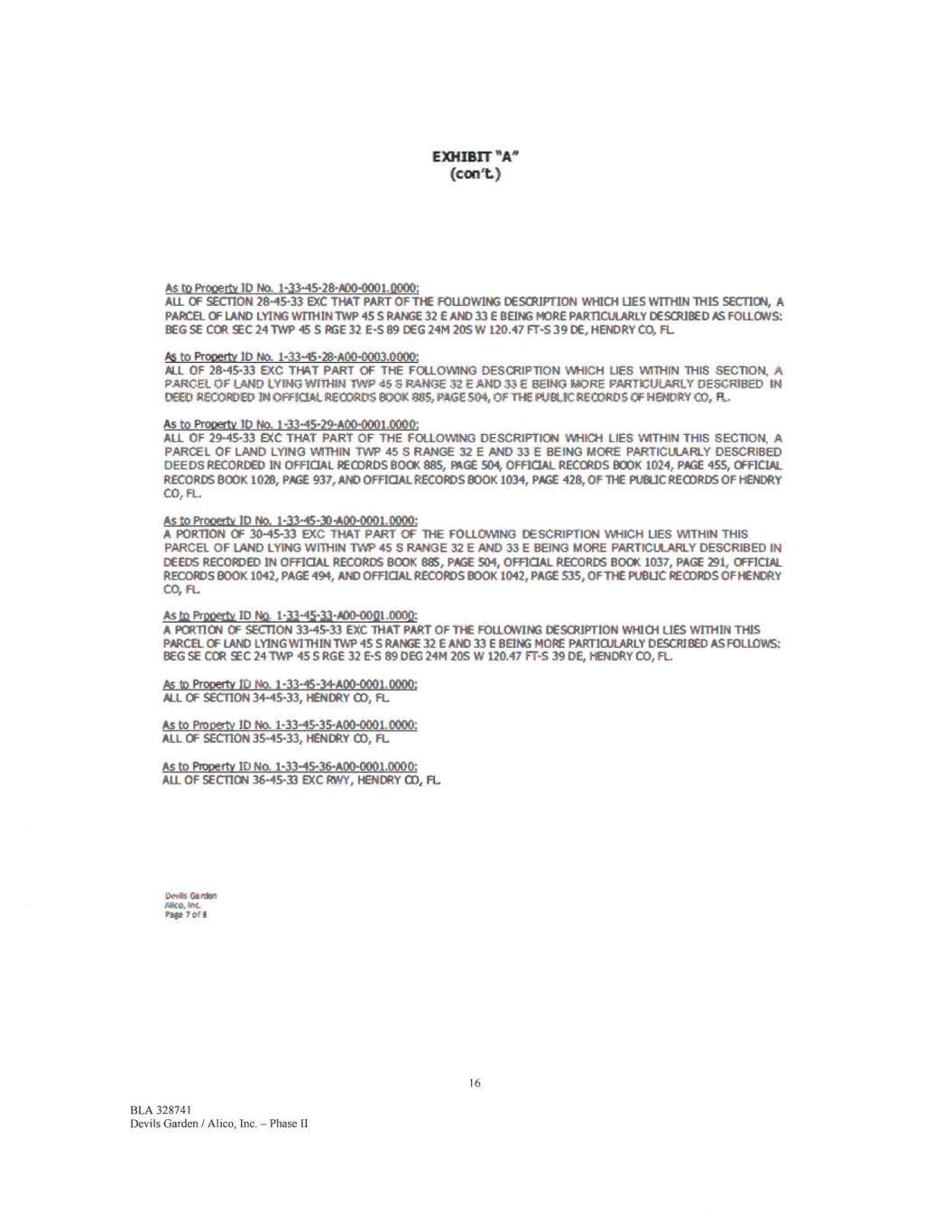
EXHIBIT "A" (Cal%) As to Prooetti ID No. 1-33-45-28-AD0-0001.12000: ALL OF SECTION 28-45-33 EXC THAT PART OF THE FOLLOWING DESCRIPTION WHICH LIES WITHIN THIS SECTION, A PARCEL OF LAND LYING WITHIN TWP 45 S RANGE 32 E AND 33 E BEING MORE PARTICULARLY DESCRIBED ik.S FOLLOWS: BEG SE COR C 241WP 45 S RGE 32 E-S 89 DEG 24M 205 W 120.47 FT-S 390€, HEMAY CO, FL P6 to Prooerty ID No. 1-33-45-28400-0003.0000: NI OF 28-45-33 EXC THAT PART OF THE FOLLOWING DESCRIPTION WHICH UES WITHIN THIS SECTION, A PARCEL OF LAND LYING WITHIN nW 455 RANGE 32 E AND 33€ BEING MORE PARTICULARLY DESCRIBED IN WED RECORDED IN OPFMAL RECORDS BOOK 8,35, PAGE 504, OF THE PUBLIC RECORDS OF HENDRY CO, P., As to Prow* ID No. 1-33-45-29400-0001.0000: ALL OF 29-45-33 RC THAT PART OF THE FOLLOWING DESCRIPTION WHICH LIES WITHIN THIS SECTION, A PARCEL OF LAND LYING WITHIN TVW 45 S RANGE 32 E AND 33 E BEING MORE PARTICULARLY DESCRIBED DEEDS RECORDED IN OFFICIAL RECORDS BOO( 885, PAGE 504, OFFICIAL RECORDS BOOK 1024, PA/SE 455, OFFICIAL RECORDS BOOK 1028, PAGE 937, AND OFFICIAL RECORDS BOOK 1034, ME 428, OF THE puetic RECORDS OF HENDRY CO, FL As to ProPettt ID No. 1-33-45-30-A00-0001.0000: A PORTION OF 30-45-33 EXC THAT PART OF THE FOLLOWING DESCRIPTION WHICH LIES WITHIN THIS PARCEL OF LAND LYING WITHIN TVVP 45 S RANGE 32 E AND 33 E BEING MORE PARTICULARLY DESCRIBED IN DEEDS RECORDED IN OFFICIAL RECORDS BOOK 88S, MX 504, OFFICIAL RECORDS BOCK 1037, PAGE 291, OFFICIAL RECORDS BOOK 1042, PAGE 494, MO OFFICIAL RECORDS BOOK 1042, PAGE 535, OF THE PUBLIC RECORDS OP HENDRY CO, FL As ta PitOeitt ID No. 1-33-45-33-A00-0001.0002: A PCRTICN OF SECTION 33-45-33 EXC THAT PART OF THE FOLLOWING DESCRIPTION WHICH LIES WITHIN THIS PARCEL OF LAND LYING vvrnim TWP 45 S RANGE 32 E AND 33€ BEING MORE PARTICULARLY DESCRIBED AS FOLLOWS BEG SE COR SEC 24 TWP 45 S RGE 32 E-S 89 DEC 24M 205 W 120.47 FT-S 39 DE, HENDRY CO, FL As to Property 11) No. 1-33-45-34A00-0001.0000; ALL OF SECTION 34-45-33, HENDRY CO, FL As to Proosty ID No. 1-33-45-35-A00-0001.0000: ALL OF SECTION 35-45-33, HENDRY CO, FL AS to Property ID No. 1-33-45-36400-0001.0000: All OF SECTION 36-45-33 INC RWY, HENDRY CO, FL Devils Gs rest Mk*. kix. Par 7 of 8 16 BLA 328741 Devils Garden / Alico, Inc. — Phase II
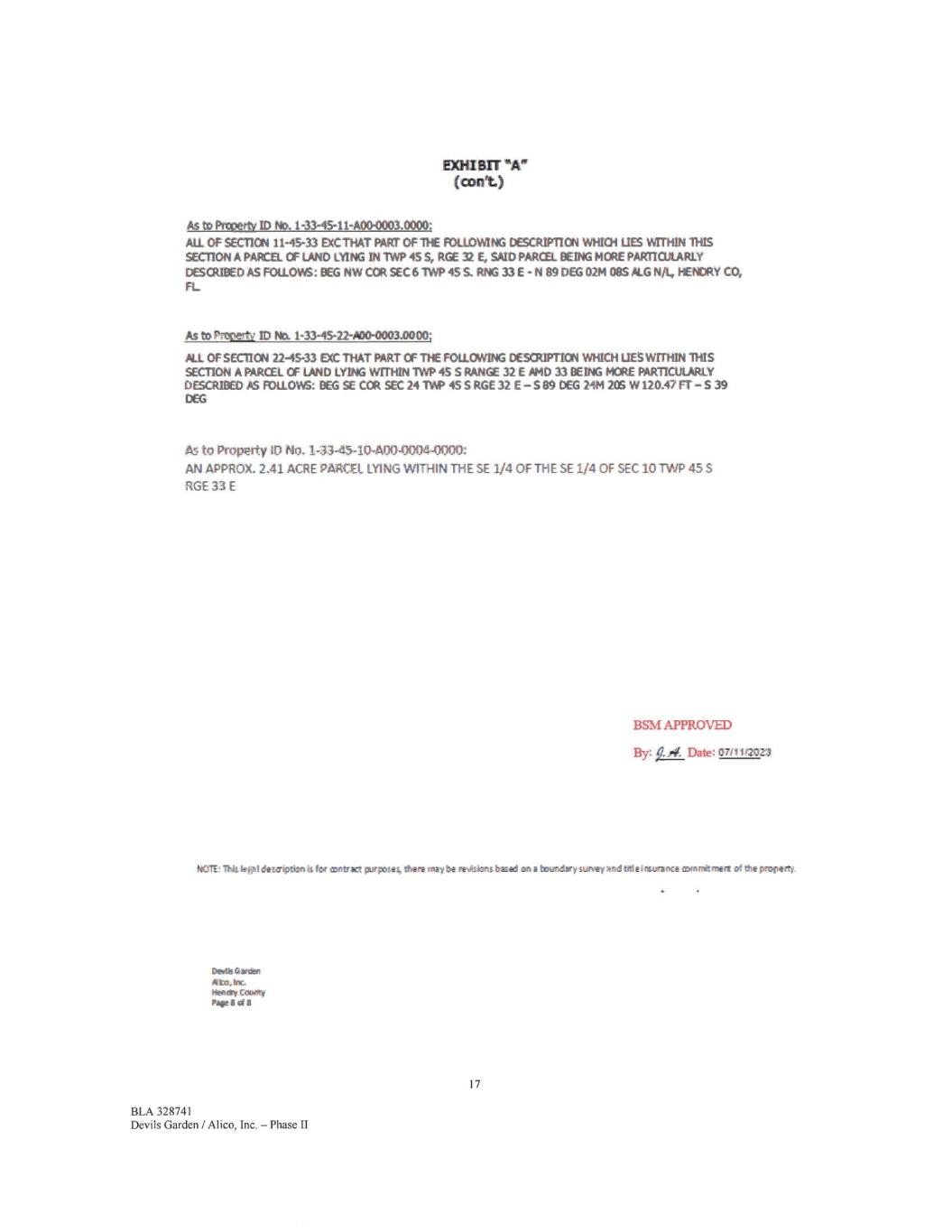
Emu BIT "A. (cont.) As to Po:petty ID No. 1-33-45-11-A00-0003.0000: ALL Of SECTION 11-45-33 EXCTHAT PART OF1HE FOLLOWING texruPnoN WHICH LIES virrHiN THIS SECTION A PARCEL OF LAND LYING ThilWP 455, RGE E, SAID PARCEL. I3EING MORE PARTICULARLY DESCRIBED AS FOLLOWS: OEG NW CM SEC 6 11NP 455. RNG 33 E - N 89 DEG 0211 08S ALA NA., HENDRY CO, FL As to Nvertv ID No. 1-33-45-22-A00-0003.0000; ALL OF SECTICN 2245-33 DX THAT PART CF THE FOLLOWING DESCRIPTION WHICH LIES WITHIN THIS SECTION A PARCEL OF LAND LYING wrnitN 1WP 45 S RANGE 32 E HID 33 BEING MORE PARTICULARLY DESCRIBED AS FOILOWS: I3EG SE COL. SEC 24 MP 45 S RGE 32 E 5 89 DEG 2114 20S W 120.47 FT — S 39 DEG A5 to Property ID No, 1-33-45-10-A00-0004-0000: AN APPROX. 2.41 ACRE PARCEL LYING WITHIN THE SE 1/4 OF THE SE 1/4 OF SEC 10 TWP 45 S RGE 33 E BSI APPROVED By.:4 Date: MI V2023 NO1E: This kf;31 description is for contrett purpose% there may be reVisions based on a boundary survey and tide insurance oonwericrneit of the property. Deans Garden aba, Inc. Heady County Page El sill 17 BLA 328741 Devils Garden / Al ico, Inc. — Phase II
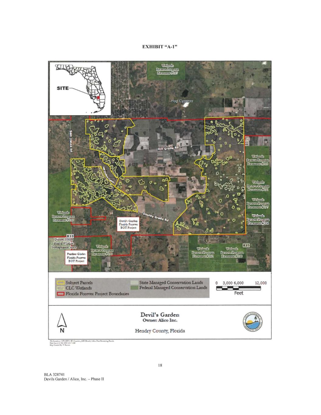
EXHIBIT "A-1" Subject Parcels CLC Wetlands C=1 Florida Forever Proiect Boundaries State Managed Conservation Lands Federal Managed Conservation Lands It. AIM Ws, Gal *r 7 Ur.. 18 BLA 328741 Devils Garden / Alice, Inc. — Phase II
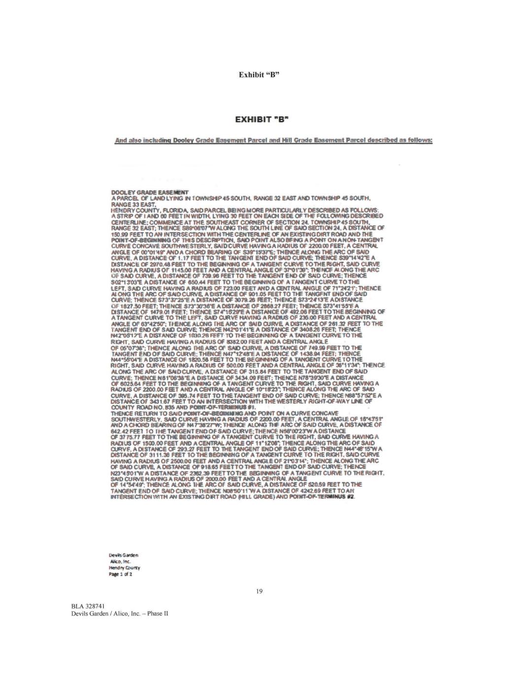
Exhibit "B" EXHIBIT "B" And also including Dooley Grade Easement Parcel and Fill Grade Easement Parcel descnInni as follow= DOOLEY GRADE EASEMENT A PARCEL. OF LAND LYING IN 1 OWNSHIP46 SOUTH, RANGE 32 EAST AND TOWNSHIP 45 SOUTH. RANGE 33 EAST, HENDRY 00UNTY, FLORIDA, SAO PARC& BONG MORE FIARTICULARLY DESMIED A.S FOLLOWS: A grow OF I *10 00 FEET IN WIDTH, LYING 30 FEET ON EACH 9 DE OPT** FIXLCANING DESCRIBED CENTERUW COM&TENCE AT THE SOUTHEAST CORNER OF SECTION 24. TOWNSHIP* SOUTH. RANGE 32 EAST; THENCE 93910607•W ALONG THE SOUTH LINE OF SAO SECTION 24, A DISTANCE OF 1$0.99 FEET TO AN INTERSECTION WITH THECENTEJRLINE OF AN EXISTING DIRT ROAD AND THE POINT.OF-GEGINNING OF THIS DESCMPTION„ SMO PONT A4800E110 A POINT ON ANONTANGINT CURVE CONCAVE SOUTTMESTERLY. SAID CURVE HAVINGA RADIUS OF 220000 FEET, A CENTRAL ANGLE Of 00101411' ANDA CHOW BEARING OF S3r1531rE; THENCE AU3010 THE PitC OF SAO CURVE, A DISTANCE Cr 1..1? FEET TO THE TANGENT ENDOF SAID CURVE 'THENCE sarovore A DISTANCE OF 2070.46 FEET TO THE BEGINNING OF A TANGENT CURVE TOTIpiE. RIGHT. SAID CURVE PAVING A RADIUS OF 1146.00 FEET NO A CENTRAL ANGLE OF 37-0119; THENCE M ONG THE ARC C/E SAID CURVE, A DISTANCE OF 739.96 FEET TO THE TANGENT END OF SAID CURVE; THENCE 8021303E A DISTANCE Of 660A4 FEET TO THE BEGINNING OF A TANGENT CURVE TOT** LEFT, SAID CURVE HAVING A RADIUS Of 723.00 FEET AND A CSYTRAL ANGLE OF 71'2421'; THENCE Al. ONG THE ARC OF SAID CURVE, A DISTANCE OF 901 DS FEET TO THE TANGENT ENDOF SAID CURVE; THENCE S73S/25-E A DISTANCE OF 307126 MET; THENCE S731413E ADISTANCE OF ierrzo FEET; THENCE S73-3016* A DISTANCE OF 266827 EEO': THENCE 6734115E A DISTANCE OF 147E01 FEET; THENCE S7e1621YE A DISTANCE OF 492.06 FEET TOTHE BEGIMING OF A TANGENT CURVE TO THE LEFT, SAO CURVE HAVING A RADIUS Of 236,00 FEET AND A CENTRAL ANGLE OF 634250`; 11ENCE ALONG THE ARC Cr SAID CURVE A DISTANCE OF 261.32 FEET 10 THE TANGENT END OF SAO CURVE THENCE 1442'0E41T A DISTANCE OF 340826 FEET: THENCE 1442'0617E A DISTANCE OF 1(tI026 WET TO THE BEGINNING OF A TANGENT CURVE TO THE ROHL SAID CuRVE HAVING A RADIUS OF 1082.00 met ANDA CENTRAL ANGLE OF 06•07136; THENCE &ONG THE ARC OF SAID CURVE, A DISTANCE Of 149.99 FEET 10 TIE TANGENT DO OF SAID CURVE THENCE N4r12.41rE A DISTANCE OF 143E94 FEET; THENCE 1444*5SO4E A DISTANCE OF 1920.56 FEET TO THE BEGINNING OF A TANGENT CURVE TO THE RIGHT, SAID CURVE HAVING A RADIUS OF 500.00 FEET AND A CENTRAL ANGLE OF 3811134*; THENCE ALONG THE ARC OF SAID CURVE, A DISTANCE OF 315_84 FEET TO THE TANGENT END OF SAID CURVE, THENICEN81'0638EA DISTANCE OF 3434.09 FEET; THENCE 14781930"E A DISTANCE OF 602564 FEET TO THE BEGINNING OF A TANGENT CURVE TO THE RIGHT, SAID CURVE HAVING A RADIUS OF 2200.00 FEET AND A MORAL ANGLE OF 10r18`23"; THENcE AU:1103 THE ARC OF SAID CURVE, A DISTANCE OF 39S .74 FEET TO THE TANGENT END OF SAID CURVE; THENCE 10313.12"StE A DISTANCE OT 343167 FEET TOM INTERSECTION Wrni THE il&ESTERLY RIGHT•OFWAY LEE OF COUNTY IROAD NO.. 835 AND POINT-OF.TERAIMIUS 11, THENCE RETURN TO SAID P0INT-CF43ECOINING AND PONT ON A CURVE CONCAVE SOUTHWESTERLY, SAID CURVE PAVING A RADIUS OF 2200.00 FEET, A.CENTRAL ANGLE OF 18'431r AND A CHORD SEARING OF 1441 .,8u W; THENCE ALONG TI-IF ARC OF SAID CURVE, A DISTANCE. OF 642.42 FEET TO THE TANGENT ENO OF SAID CURVE THENCE s56'o0r2TW A DISTANCE OF 37 /5.37 FEET TO THE BEGINNING OF &TANGENT CURVE TO THE RIGHT; SAID CURIE HAVING A RADIUS OF 1500,00 FEET AND A CENTRAL ANGLE OF 1i'12061 THENCE ALONG THE ARC OF SAID CURVE, A DISTANCE OF 203.27 FEET TO THE TANGENT END OF SAID CURVE;. THENCE 1444*413415W A DISTANCE OF 3111.30 FEET TO THE BEGINNING OF A TANGENT CURVE TO THE 1111311T, SAID CURVE HAVING A RADIUS OF 260900 FEET' AND A CENTRAL ANGLE OF 21'0314'; THENCE ALONG THE ARC OF $AID CURVE A DISTANCE OF 91865 FEETTO THE TANGENT ENDOF SAID CURVE THENCE 123*4 601"0/ A DISTANCE OF 2182.39 FEET TO THE EIEGINMNG OF A TANGENT CURVE TO THE RIGHT, SAID CURVE HAVING A RADIUS OF 2000,00 FEET AND A CENTRAL ANGLE OF 14144111-, THENCE ALONG THE ARC Of SAID CURVE, A DISTANCE OF 62059 FEET TO THE TANGENT END OF SAID CURVE; THENCE N001i0111N A DISTANCE OF 4242E9 FEET TO Art NTERSECIION WITH AN ExiSTiNG ORT ROAD 111111 GRADE) AND POINT-0/mIVROONIIS 92. Dells Gaidee, Alto, W. Plenclfy awry, Page I 012 19 BLA 328741 Devils Garden / Alico, Inc. -Phase II
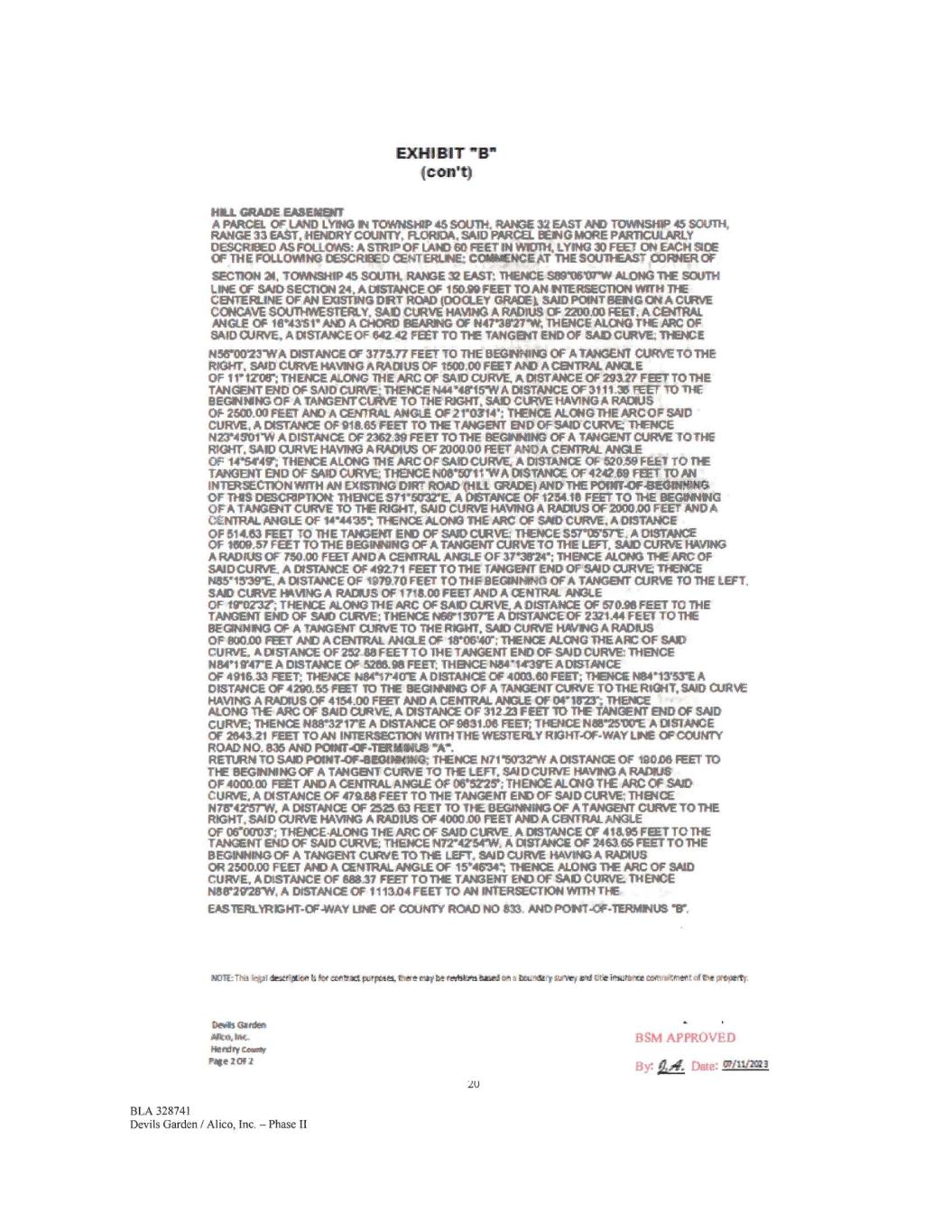
EXHIBIT "BP" (con't) HILL GRADE EASEMENT A PARCEL OF LAND LYING IN TOWNSHIP 45 SOUTH, RANGE 32 EAST A143 TOWNSHIP 45 SOUTH, RANGE 33 EAST. HENDRY coutim RORDA. SAID PARCEL BEING MORE PARTICULARLY DESCRIBED AS FOLD:A& A STRIP OF LANDED FEET MUM LYING 30 FEET ON EACH SIDE OF THE IFOLLOVIING DESCREED CENTERLINE; COMMENCE AT THE SOUTHEAST CORNER OF SECTION al, TOWNSHIP 45 SOUTH, RANGE 32 EAST; 'THENCE SOIY051ITVI ALONG 'THE SOUTH LINE Cr SAID SECTION 24, A DISTANCE OF 15099 FEET TO AN INTERSECTION MTH THE COVERLINE OF AN EXISTING OW ROW (DOCLEY GRADE I, SAID POINT BEING ON A CURVE CONCAVE SOUTHWESTERLY. SAID CURVE HAVING A RADIUS OF 2200.00 META CENTRAL ANGLE OF urosi" AND A CHORD BEARING OF N47"38'27**. THENCE ALONG THE ARC OF SAID CURVE. A DISTANCE OF 542.42 FEET TO THE TANGENT END OF SAD CURVE; THENCE N56•0073WA DISTANCE OF 377577 FEET TO THE BEGINNING OF A TANGENT CURVE TO PIE RIGHT. SAID CURVE HAVING A RADIUS OF 1500.00 FEET AND A CENTRAL ANGLE OF 11'12105'; THENCE ALONG THE ARC OF SAID CURVE, A DIS'TANCE OF 29127 FEET TO THE TANGENT END OF SAID CURVE THENCE N44'48I5'W A DISTANCE OF 3111.35 FEET TO THE BEGINNING OF A TANGENTCURVE TO THE RIGHT. SAID CURVE HAVING A RADIUS OF 2500.00 FEET AND A CENTRAL ANGLE OF 21410314% THENCE ALONG THE ARCOF SAID CURVE. A DISTANCE OF 91565 FEET TO TIE TANGENT END OF SAID CURVE; THENCE N23NISO1V10 A DISTANCE OF 2362.39 FEET TO THE BEGINNING OF A TANGENT CURVE TOTHE RIGHT. SAID CURVE HAVING A RADIUS OF 200090 FEET ANDA CENTRAL ANGLE OF 14•5149% THENCE ALONG THE ARC OF SAID CURVE A DISTANCE OF 52059 FEET TO TIE TANGENT END or mit) CANM THENCE NOVECTITIVA DISTANCE OF 4242.69 FEET TO AN IN'TERSEcroN WITH AN EXISTING DIRT ROAD (HILL GRADE, AND THE POINT.43F-BEGOOMIG OF THIS DESCRIPTION THENCE S71•51732E, A MANCE OF 125418 FEET TO THE BEGINNING OF A TANGENT CURVE TO THE RIGHT, SAID CURVE HAVING A RADIUS OF 2000.00 FEET AND A CENTRAL ANGLE OF 14•4435`. 'THENCE ALONG THE ARC OF SAID CURVE, A DISTANCE OF 514.53 FEET TO THE TANGENT END OF SAID CURVE; THENCE S57•05'57T, A DISTANCE OF 1509.57 FEET TONE Br:SINNING OF A TANGENT CURVE TO THE LEFT. SAID CURVE RAVING A RADIUS OF 750,00 FEET AND A CENTRAL AMU OF 37131124% THENCE ALONG THE ARC OF SAID CURVE. A INSTANCE OF 492.71 FEET TO THE TANGENT END OF SAID CURVE THENCE 15595'39'E. A DISTANCE OF 107970 FEET TO THE BEGINNING OF A TANGENT CURVE TO THE LEFT, SAID CURVE HAVING A RADIUS OF 1716.00 FEET AND A CENTRAL ANGLE OF 141•0272% THENCE MONO THE ARC OF SAID CURVE. A DISTANCE OF 57016 FEET TO THE TANGENT END OF SAID CURVE: THENCE Nerl 30TE A DISTANCE OF 2321.44 FEET TONE BEGINNING Of A TANGENT CURVE TO THE RIGHT, SAID CURVE HAVING A RADIUS OF 900.00 FEET At4) A CENTRAL ANGLE OF 18'0640"; THENCE ALONG THE AFC OF SAID CURVE. A DISTANCE OF 25218 FEET TO THE TANGENT END OF SAID CURVE THENCE N84'1 awre A DISTANCE OF 5205.911 FEET; THENCE 14541439E A DISTANCE OF 491E33 FEET: THENCE 1484•171CrE A DISTANCE OF 4003.60 FEET; THENCE N84-1353E A DISTANCE OF 4290.55 FEET TONE BEGINNING OF A TANGENT CURVE TOTHE RIGHT. SAID CURVE HAVING A RADIUS OF 4154.00 FEET AND A CENTRAL ANGLE OF 04'16= THENCE ALONG THE ARC OF SAID CURVE. A DISTANCE OF 31223 FEET 10 THE TANGENT END OF SAID CURVE; THENCE N8843217E A DISTANCE OF 9631.06 FEET; THENCE N68'2SWE A DISIANCE OF 264321 FEET TO AN INTERSECTION WITH THE WESTEIRLY RIGHT-OF-WAY LINE OF COUNTY ROAD No. 835 AND POINT43F.TERSIINUS "1/4". RETURN TO SAID POINT-OF41,0110e1M; THENCE N71110732W A DISTANCE OF 190.06 FEET 113 THE BEGINNING OF A TANGENT CURVE TO ThE LEFT, SAJDCURVE HAVING A RADIUS OF 4000.00 FEET- MICA CENTRAL ANGLE Of 06"5225'; THENCE ALONG TIE ARC Of SAID CURvE, A DISTANCE OF 47188 FEET TONE TANGENT END OF SAID CURVE; THENCE N71114216TW, A DISTANCE OF 252953 FEET TO THE BEGINNING OF A TANGENT CURVE TO THE RIGHT, SAID CURVE HAVING A RADIUS OF 4000.00 FEET MICA CENTRAL ANGLE OF 06.00107; THENCE•ALOFIG THE ARC OF SAID CURVE A DISTANCE Cr 41395 FEET TO THE TANGENT END OF SAID CURVE THENCE N72"4754"W„ A DISTANCE OF 2463.66 FEET TO THE BEGINNING OF A TANGENT CURVE TO THE LOT, SAID CURVE HAWING A RADIUS OR 2500.00 FEET AND A CENTRAL ANGLE OF 154'46'341 THENCE ALONG THE ARC OF SAID CURVE. A DISTANCE OF 68037 FEET TO THE TANGENT EtEI OF SAID CURVE. THENCE 148r2921rW, A DISTANCE OF 1113,04 FEET TO AN INTERSECTION 101114 THE EAS1ERLYRZHT-OF.WAY LINE OF COUNTY ROAD NO 533. AND POINT-OF-TIERMINUS KIC/TE: Thit tcfp I dte$Jo a COlittal purpteret, Inert intobe tedibti based on baumeary neve( ard dcieinstipece conmsterleoti nil?* pritileyty. Ds Garden Mr 6, Inc Hendry tom* Page ZOF 2 20 BLA 328741 Devils Garden / Alico, Inc. - Phase II EISM APPROVED By: Liz Date: 07/11.12a2
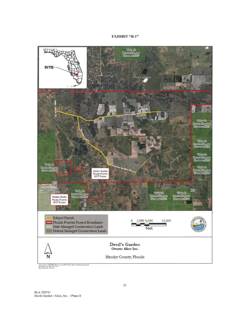
EXHIBIT "B-1" Subject Parcels Florida Forever Project Boundaries 3,000 6,000 12,00fia = State Managed Conservation Lands Feet Federal Managed Conservation Lands Devil's Garden Owner: Ahco Inc. Hendry County, Florida f &UNA. OPU21191.4‘0.4.4.1.026,04.4.,...114.1eneeioim,Pairf. riblierrodi 7.140 /611 MAI /at 114. /10, I More* 21 BLA 328741 Devils Garden / Alico, Inc. — Phase II
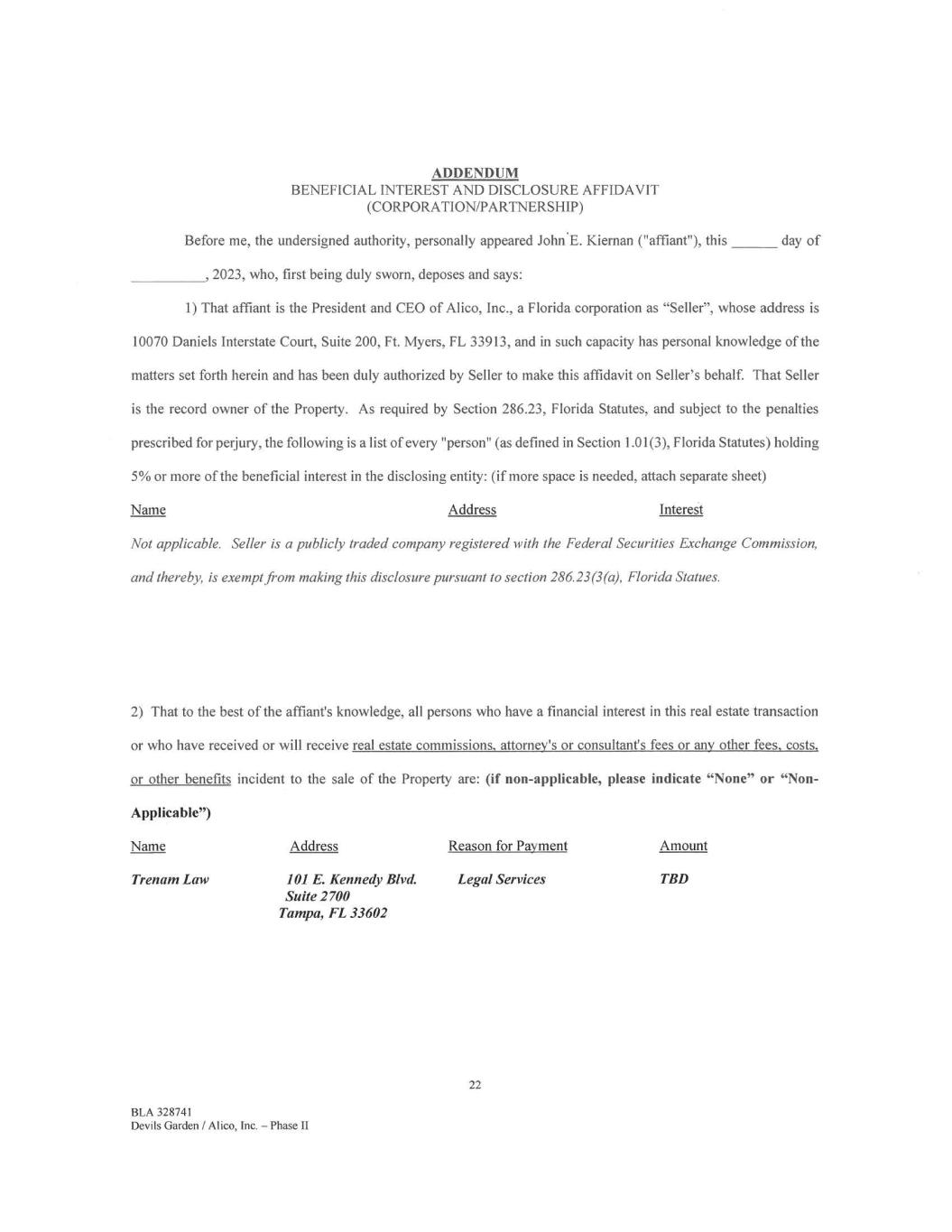
ADDENDUM BENEFICIAL INTEREST AND DISCLOSURE AFFIDAVIT (CORPORATION/PARTNERSHIP) Before me, the undersigned authority, personally appeared John.E. Kiernan ("affiant"), this day of ,2023, who, first being duly sworn, deposes and says: 1) That affiant is the President and CEO of Alico, Inc., a Florida corporation as "Seller", whose address is 10070 Daniels Interstate Court, Suite 200, Ft. Myers, FL 33913, and in such capacity has personal knowledge of the matters set forth herein and has been duly authorized by Seller to make this affidavit on Seller's behalf. That Seller is the record owner of the Property. As required by Section 286.23, Florida Statutes, and subject to the penalties prescribed for perjury, the following is a list of every "person" (as defined in Section 1.01(3), Florida Statutes) holding 5% or more of the beneficial interest in the disclosing entity: (if more space is needed, attach separate sheet) Name Address Interest Not applicable. Seller is a publicly traded company registered with the Federal Securities Exchange Commission, and thereby, is exempt from making this disclosure pursuant to section 286.23(3(a), Florida Statues. 2) That to the best of the affiant's knowledge, all persons who have a financial interest in this real estate transaction or who have received or will receive real estate commissions, attorney's or consultant's fees or any other fees, costs, or other benefits incident to the sale of the Property are: (if non-applicable, please indicate "None" or "Non - Applicable") Name Address Reason for Payment Amount Trenam Law 101 E. Kennedy Blvd. Legal Services TBD Suite 2700 Tampa, FL 33602 22 BLA 328741 Devils Garden / Alico, Inc. — Phase II
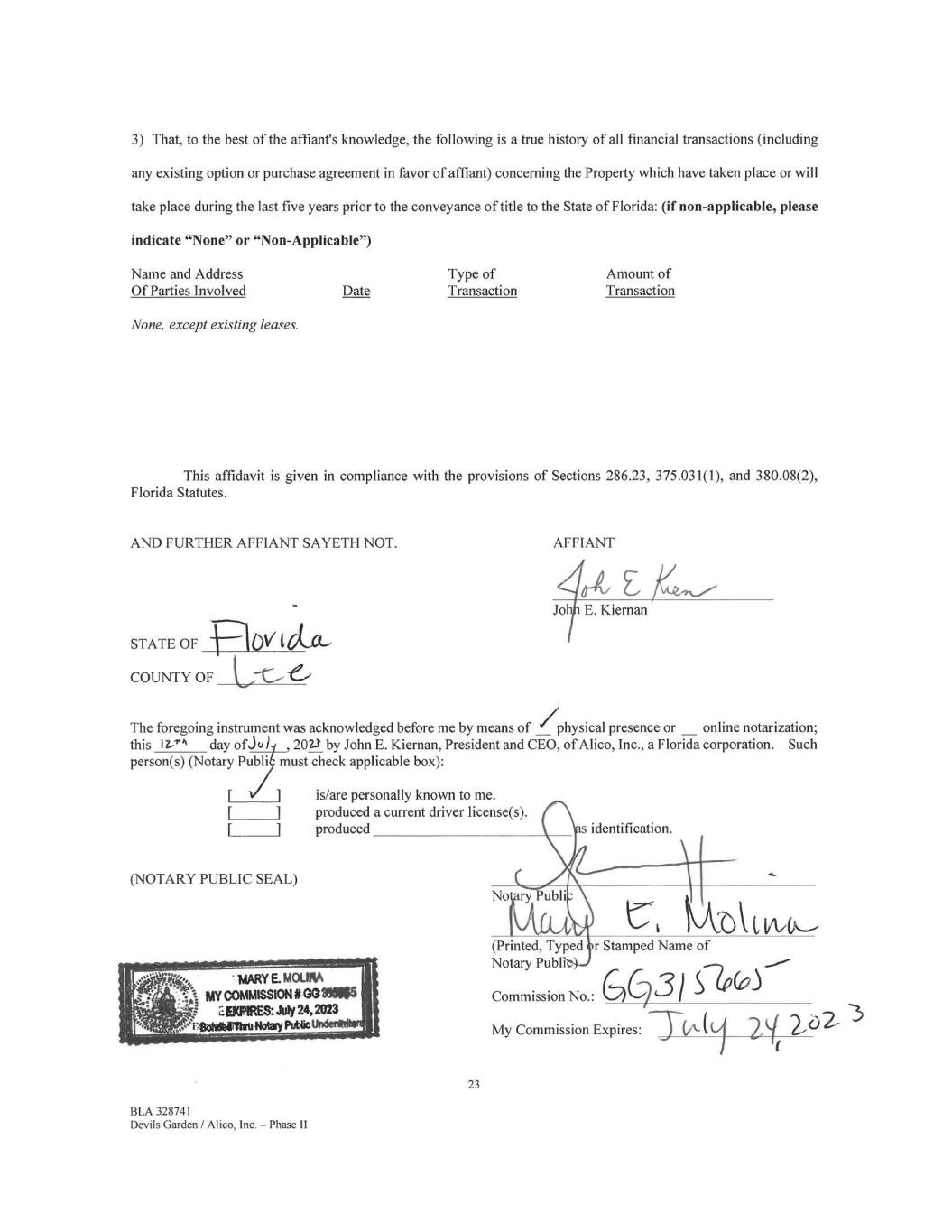
3) That, to the best of the affiant's knowledge, the following is a true history of all financial transactions (including any existing option or purchase agreement in favor of affiant) concerning the Property which have taken place or will take place during the last five years prior to the conveyance of title to the State of Florida: (if non-applicable, please indicate "None" or "Non-Applicable") Name and Address Type of Amount of Of Parties Involved Date Transaction Transaction None, except existing leases. This affidavit is given in compliance with the provisions of Sections 286.23, 375.031(1), and 380.08(2), Florida Statutes. AND FURTHER AFFIANT SAYETH NOT. STATE OF COUNTY OF AFFIANT The foregoing instrument was acknowledged before me by means of /physical presence or online notarization; this 17-'4 day ofJc. 1 , 2023 by John E. Kiernan, President and CEO, of Alico, Inc., a Florida corporation. Such person(s) (Notary Publi must check applicable box): is/are personally known to me. produced a current driver license(s). produced s identification. (NOTARY PUBLIC SEAL) 23 BLA 328741 Devils Garden / Al ico, Inc. — Phase II No ry Publi 'CA 1A/OL (Printed, Typed ir Stamped Name of Notary Publi Commission No.: GC731 S10(0) My Commission Expires:
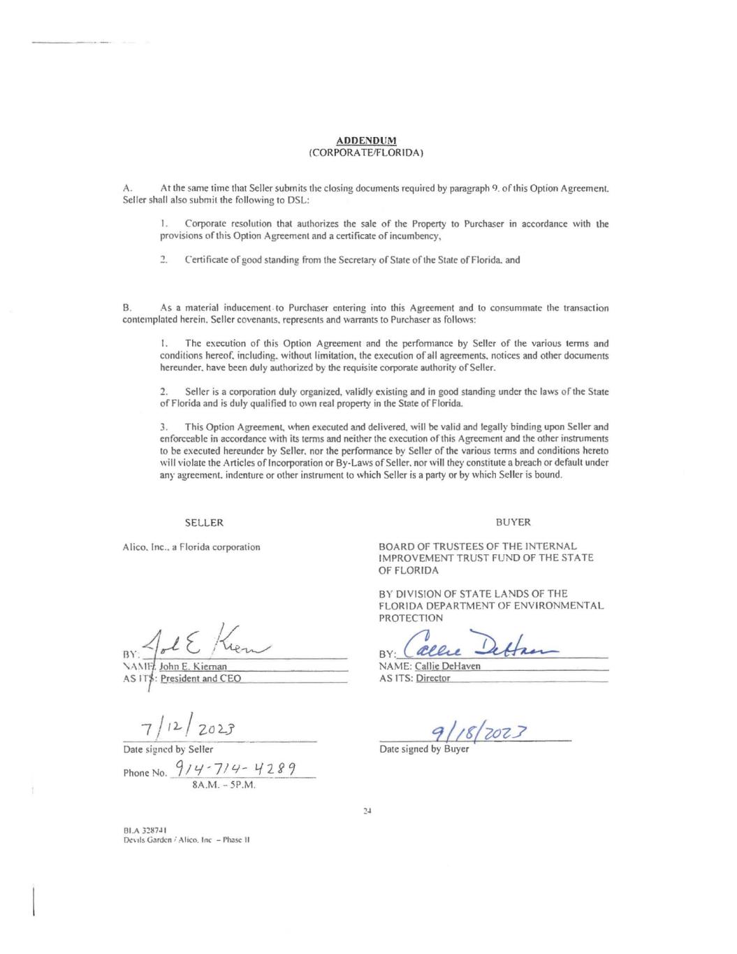
ADDENDUM (CORPORATE/FLORIDA) A. At the same time that Seller submits the closing documents required by paragraph 9. of this Option Agreement. Seller shall also submit the following to DSL: I. Corporate resolution that authorizes the sale of the Property to Purchaser in accordance with the provisions of this Option Agreement and a certificate of incumbency, 2. Certificate of good standing from the Secretary of State of the State of Florida. and B. As a material inducement. to Purchaser entering into this Agreement and to consummate the transaction contemplated herein. Seller covenants, represents and warrants to Purchaser as follows: I. The execution of this Option Agreement and the perfomiance by Seller of the various terms and conditions hereof, including, without limitation, the execution of all agreements, notices and other documents hereunder, have been duly authorized by the requisite corporate authority of Seller. 2. Seller is a corporation duly organized, validly existing and in good standing under the laws of the State of Florida and is duly qualified to own real property in the State of Florida. 3. This Option Agreement, when executed and delivered, will be valid and legally binding upon Seller and enforceable in accordance with its terms and neither the execution of this Agreement and the other instruments to be executed hereunder by Seller, nor the performance by Seller of the various terms and conditions hereto will violate the Articles of Incorporation or By-Laws of Seller. nor will they constitute a breach or default under any agreement. indenture or other instrument to which Seller is a party or by which Seller is bound. SELLER BUYER A lie°, Inc.. a Florida corporation BOARD OF TRUSTEES OF THE INTERNAL IMPROVEMENT TRUST FUND OF THE STATE OF FLORIDA BY DIVISION OF STATE LANDS OF THE FLORIDA DEPARTMENT OF ENVIRONMENTAL PROTECTION -41 E BY. BY: reeet-e- \ A MI'. John E. Kiernan NAME: Callie DeHaven AS IT.: President and CEO AS ITS: Director 7 / ZO Date signed by Seller Phone No. 9/9-7/t9-- Li 2 P 9 8A.M. - 5P.M. 131.A 328741 Devils Garden I Alico. Inc — Phase II 2-1 9//063.7 Date signed by Buyer